Bovisio-Masciago elevation
Bovisio-Masciago (Lombardy, Provincia di Monza e della Brianza), Italy elevation is 190 meters and Bovisio-Masciago elevation in feet is 623 ft above sea level [src 1]. Bovisio-Masciago is a seat of a third-order administrative division (feature code) with elevation that is 132 meters (433 ft) smaller than average city elevation in Italy.
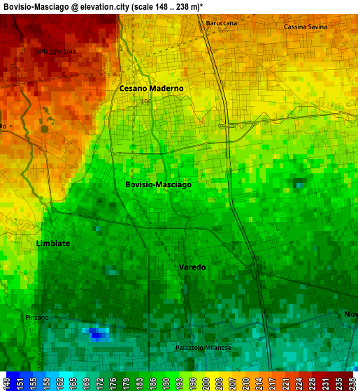
Below is the Elevation map of Bovisio-Masciago, which displays elevation range with different colors. Scale of the first map is from 148 to 238 m (486 to 781 ft) with average elevation of 193.1 meters (=634 ft) [note 1]
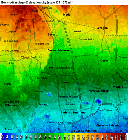
These maps also provides idea of topography and contour of this city, they are displayed at different zoom levels. More info about maps, scale and edge coordinates you can find below images.
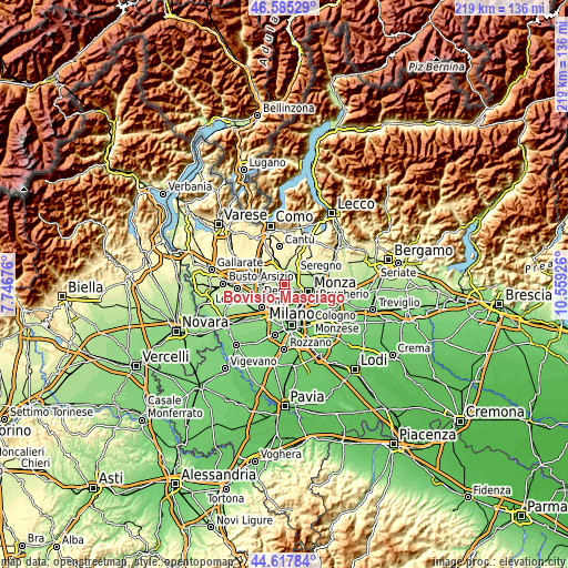
| \ | Map #1 | Map #2 | Topo.Map |
| Scale [m] | 148..238 m | 139..272 m | × |
| Scale [ft] | 486..781 ft | 456..892 ft | × |
| Average | 193.1 m = 634 ft | 196.7 m = 645 ft | × |
| Width | 6.84 km = 4.3 mi | 13.67 km = 8.5 mi | 218.8 km = 136 mi |
| Height | 6.84 km = 4.3 mi | 13.67 km = 8.5 mi | 218.7 km = 135.9 mi |
| ↑Max Latitude | 45.640923° | 45.671639° | 46.58529° |
| Latitude at center | 45.61019° | 45.61019° | 45.61019° |
| ↓Min Latitude | 45.57944° | 45.548674° | 44.61784° |
| ← Min Longitude | 9.109065° | 9.065119° | 7.74676° |
| Longitude center | 9.15301° | 9.15301° | 9.15301° |
| →Max Longitude | 9.196955° | 9.240901° | 10.55926° |
Nearby cities:
Cities around Bovisio-Masciago sort by population:
• Paderno Dugnano elevation 166 m
4.7 km,  168°
168°
• Desio 198 m
4 km,  76°
76°
• Cesano Maderno 202 m
2.1 km,  357°
357°
• Limbiate 183 m
2.5 km,  241°
241°
• Seveso 211 m
4.1 km,  349°
349°
• Meda 221 m
5.7 km,  0°
0°
• Nova Milanese 179 m
4.2 km,  124°
124°
• Senago 167 m
4.4 km,  208°
208°
• Varedo 183 m
1.6 km,  150°
150°
• Solaro 205 m
5.5 km,  274°
274°
• Barlassina 231 m
5.4 km,  339°
339°
• Villaggio del Sole 208 m
3.6 km,  276°
276°
Multilingual:
 En español:
Bovisio-Masciago elevación 190 m.
 En France:
Bovisio-Masciago élévation 190 m.
 Auf Deutsch:
Bovisio-Masciago höhe über dem Meeresspiegel ist 190 m.

Sources and notes:
- [note 1] Map square and city borders are not equal. Map elevation data is calculated only from area inside that square.
- [src 1] Elevation data from geonames database provided with same terms of usage.
- [src 2] The elevation map of Bovisio-Masciago is generated using elevation data from NASA's 3 arcsec (90m) resolution SRTM data.
- [src 3] Base (background) map © OpenStreetMap contributors tiles are generated by Geofabrik and OpenTopoMap.
Copyright & License:
This Bovisio-Masciago Elevation Map is licensed under CC BY-SA. You may reuse any part from this page, if you give a proper credit by linking to this URL:
 More info on terms of use page.