Brenna elevation
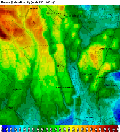
Brenna (Lombardy, Provincia di Como), Italy elevation is 358 meters and Brenna elevation in feet is 1175 ft above sea level [src 1]. Brenna is a seat of a third-order administrative division (feature code) with elevation that is 36 meters (118 ft) bigger than average city elevation in Italy.
Below is the Elevation map of Brenna, which displays elevation range with different colors. Scale of the first map is from 255 to 448 m (837 to 1470 ft) with average elevation of 336.2 meters (=1103 ft) [note 1]
These maps also provides idea of topography and contour of this city, they are displayed at different zoom levels. More info about maps, scale and edge coordinates you can find below images.
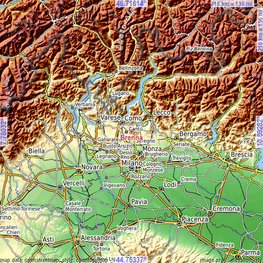
| \ | Map #1 | Topo.Map |
| Scale [m] | 255..448 m | × |
| Scale [ft] | 837..1470 ft | × |
| Average | 336.2 m = 1103 ft | × |
| Width | 6.82 km = 4.2 mi | 218.2 km = 135.6 mi |
| Height | 6.82 km = 4.2 mi | 218.2 km = 135.6 mi |
| ↑Max Latitude | 45.77404° | 46.71614° |
| Latitude at center | 45.74338° | 45.74338° |
| ↓Min Latitude | 45.712703° | 44.75337° |
| ← Min Longitude | 9.142625° | 7.78032° |
| Longitude center | 9.18657° | 9.18657° |
| →Max Longitude | 9.230515° | 10.59282° |
Nearby cities:
Cities around Brenna sort by population:
• Cantù elevation 362 m
4.3 km,  266°
266°
• Giussano 273 m
5.1 km,  160°
160°
• Mariano Comense 254 m
5.2 km,  184°
184°
• Inverigo 333 m
2.5 km,  103°
103°
• Carugo 275 m
4 km,  168°
168°
• Arosio 299 m
3.2 km,  147°
147°
• Lurago d'Erba 347 m
2.6 km,  71°
71°
• Alzate Brianza 356 m
3 km,  353°
353°
• Lambrugo 294 m
4.5 km, 67°
• Orsenigo 374 m
3.9 km, 352°
• Anzano del Parco 323 m
3.1 km,  15°
15°
• Alserio 265 m
4.1 km,  14°
14°
Multilingual:
 En español:
Brenna elevación 358 m.
 En France:
Brenna élévation 358 m.


Sources and notes:
- [note 1] Map square and city borders are not equal. Map elevation data is calculated only from area inside that square.
- [src 1] Elevation data from geonames database provided with same terms of usage.
- [src 2] The elevation map of Brenna is generated using elevation data from NASA's 3 arcsec (90m) resolution SRTM data.
- [src 3] Base (background) map © OpenStreetMap contributors tiles are generated by Geofabrik and OpenTopoMap.
Copyright & License:
This Brenna Elevation Map is licensed under CC BY-SA. You may reuse any part from this page, if you give a proper credit by linking to this URL:
 More info on terms of use page.