Lambrugo elevation
Lambrugo (Lombardy, Provincia di Como), Italy elevation is 294 meters and Lambrugo elevation in feet is 965 ft above sea level [src 1]. Lambrugo is a seat of a third-order administrative division (feature code) with elevation that is 28 meters (92 ft) smaller than average city elevation in Italy.
Below is the Elevation map of Lambrugo, which displays elevation range with different colors. Scale of the first map is from 230 to 394 m (755 to 1293 ft) with average elevation of 292.1 meters (=958 ft) [note 1]
These maps also provides idea of topography and contour of this city, they are displayed at different zoom levels. More info about maps, scale and edge coordinates you can find below images.
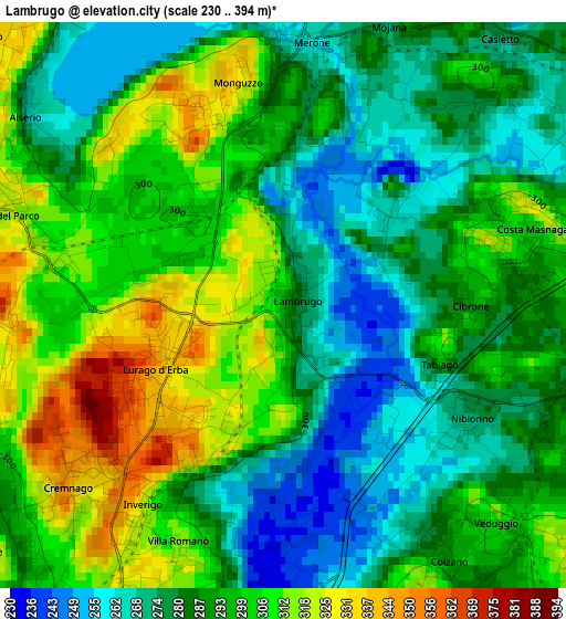
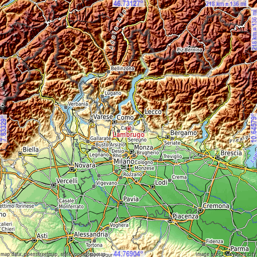
| \ | Map #1 | Topo.Map |
| Scale [m] | 230..394 m | × |
| Scale [ft] | 755..1293 ft | × |
| Average | 292.1 m = 958 ft | × |
| Width | 6.82 km = 4.2 mi | 218.2 km = 135.6 mi |
| Height | 6.82 km = 4.2 mi | 218.2 km = 135.6 mi |
| ↑Max Latitude | 45.789431° | 46.73127° |
| Latitude at center | 45.75878° | 45.75878° |
| ↓Min Latitude | 45.728112° | 44.76904° |
| ← Min Longitude | 9.195595° | 7.83329° |
| Longitude center | 9.23954° | 9.23954° |
| →Max Longitude | 9.283485° | 10.64579° |
Nearby cities:
Cities around Lambrugo sort by population:
• Inverigo elevation 333 m
2.8 km,  215°
215°
• Lurago d'Erba 347 m
1.9 km,  242°
242°
• Veduggio Con Colzano 299 m
3.7 km,  139°
139°
• Merone 264 m
3.2 km,  6°
6°
• Costa Masnaga 312 m
3.1 km,  67°
67°
• Bulciago 286 m
3.7 km,  104°
104°
• Rogeno 294 m
3.7 km,  45°
45°
• Nobile-Monguzzo 334 m
2.5 km,  343°
343°
• Tabiago-Cibrone 293 m
2.1 km, 97°
• Anzano del Parco 323 m
3.5 km,  291°
291°
• Nibionno 275 m
2.7 km,  120°
120°
• Alserio 265 m
3.8 km,  306°
306°
Multilingual:
 En español:
Lambrugo elevación 294 m.
 En France:
Lambrugo élévation 294 m.
 Auf Deutsch:
Lambrugo höhe über dem Meeresspiegel ist 294 m.

Sources and notes:
- [note 1] Map square and city borders are not equal. Map elevation data is calculated only from area inside that square.
- [src 1] Elevation data from geonames database provided with same terms of usage.
- [src 2] The elevation map of Lambrugo is generated using elevation data from NASA's 3 arcsec (90m) resolution SRTM data.
- [src 3] Base (background) map © OpenStreetMap contributors tiles are generated by Geofabrik and OpenTopoMap.
Copyright & License:
This Lambrugo Elevation Map is licensed under CC BY-SA. You may reuse any part from this page, if you give a proper credit by linking to this URL:
 More info on terms of use page.