Calizzano elevation
Calizzano (Liguria, Provincia di Savona), Italy elevation is 651 meters and Calizzano elevation in feet is 2136 ft above sea level [src 1]. Calizzano is a seat of a third-order administrative division (feature code) with elevation that is 329 meters (1079 ft) bigger than average city elevation in Italy.
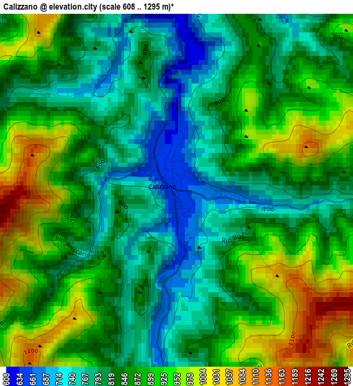
Below is the Elevation map of Calizzano, which displays elevation range with different colors. Scale of the first map is from 608 to 1295 m (1995 to 4249 ft) with average elevation of 855.7 meters (=2807 ft) [note 1]
These maps also provides idea of topography and contour of this city, they are displayed at different zoom levels. More info about maps, scale and edge coordinates you can find below images.
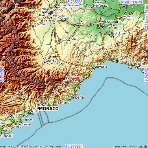
| \ | Map #1 | Topo.Map |
| Scale [m] | 608..1295 m | × |
| Scale [ft] | 1995..4249 ft | × |
| Average | 855.7 m = 2807 ft | × |
| Width | 7 km = 4.3 mi | 224.1 km = 139.2 mi |
| Height | 7 km = 4.3 mi | 224 km = 139.2 mi |
| ↑Max Latitude | 44.267597° | 45.23503° |
| Latitude at center | 44.23612° | 44.23612° |
| ↓Min Latitude | 44.204626° | 43.21996° |
| ← Min Longitude | 8.074225° | 6.71192° |
| Longitude center | 8.11817° | 8.11817° |
| →Max Longitude | 8.162115° | 9.52442° |
Nearby cities:
Cities around Calizzano sort by population:
• Garessio elevation 578 m
8.6 km,  247°
247°
• Bagnasco 488 m
9.5 km,  322°
322°
• Murialdo 517 m
9.8 km,  23°
23°
• Bardineto 716 m
5.3 km,  165°
165°
• Bormida 586 m
10.2 km,  62°
62°
• Piano 520 m
9.8 km, 23°
• Osiglia 669 m
8.3 km,  52°
52°
• Priola 548 m
7.8 km,  277°
277°
• Erli 326 m
11.1 km,  185°
185°
• Perlo 745 m
11 km,  346°
346°
• Massimino 535 m
8 km,  332°
332°
• Rialto 362 m
11.5 km,  95°
95°
Multilingual:
 En español:
Calizzano elevación 651 m.
 En France:
Calizzano élévation 651 m.
 Auf Deutsch:
Calizzano höhe über dem Meeresspiegel ist 651 m.

Sources and notes:
- [note 1] Map square and city borders are not equal. Map elevation data is calculated only from area inside that square.
- [src 1] Elevation data from geonames database provided with same terms of usage.
- [src 2] The elevation map of Calizzano is generated using elevation data from NASA's 3 arcsec (90m) resolution SRTM data.
- [src 3] Base (background) map © OpenStreetMap contributors tiles are generated by Geofabrik and OpenTopoMap.
Copyright & License:
This Calizzano Elevation Map is licensed under CC BY-SA. You may reuse any part from this page, if you give a proper credit by linking to this URL:
 More info on terms of use page.