Campodarsego elevation
Campodarsego (Veneto, Provincia di Padova), Italy elevation is 13 meters and Campodarsego elevation in feet is 43 ft above sea level [src 1]. Campodarsego is a seat of a third-order administrative division (feature code) with elevation that is 309 meters (1014 ft) smaller than average city elevation in Italy.
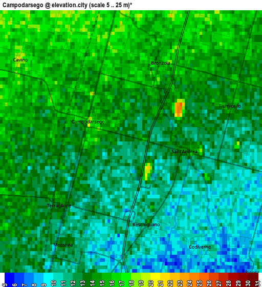
Below is the Elevation map of Campodarsego, which displays elevation range with different colors. Scale of the first map is from 5 to 25 m (16 to 82 ft) with average elevation of 12.8 meters (=42 ft) [note 1]
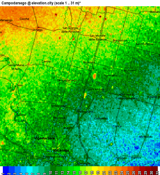
These maps also provides idea of topography and contour of this city, they are displayed at different zoom levels. More info about maps, scale and edge coordinates you can find below images.
| \ | Map #1 | Map #2 | Topo.Map |
| Scale [m] | 5..25 m | 1..31 m | × |
| Scale [ft] | 16..82 ft | 3..102 ft | × |
| Average | 12.8 m = 42 ft | 13.5 m = 44 ft | × |
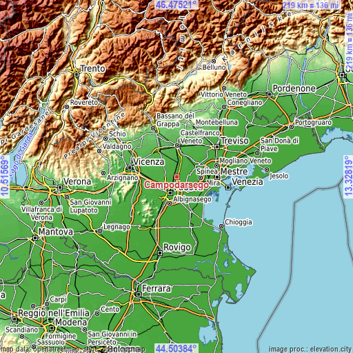
| Width | 6.85 km = 4.3 mi | 13.7 km = 8.5 mi | 219.2 km = 136.2 mi |
| Height | 6.85 km = 4.3 mi | 13.7 km = 8.5 mi | 219.2 km = 136.2 mi |
| ↑Max Latitude | 45.528944° | 45.559722° | 46.47521° |
| Latitude at center | 45.49815° | 45.49815° | 45.49815° |
| ↓Min Latitude | 45.467339° | 45.436511° | 44.50384° |
| ← Min Longitude | 11.877995° | 11.834049° | 10.51569° |
| Longitude center | 11.92194° | 11.92194° | 11.92194° |
| →Max Longitude | 11.965885° | 12.009831° | 13.32819° |
Nearby cities:
Cities around Campodarsego sort by population:
• Mejaniga elevation 11 m
4.7 km,  195°
195°
• San Giorgio delle Pertiche 23 m
5.2 km,  335°
335°
• Vigodarzere 14 m
5.3 km,  212°
212°
• Borgoricco-San Michele delle Badesse-Sant'Eufemia 18 m
4.4 km,  19°
19°
• Villanova 12 m
4.2 km,  104°
104°
• Cadoneghe 10 m
6.2 km,  175°
175°
• Pionca 9 m
4.8 km,  138°
138°
• Santa Maria di Non 18 m
5.6 km,  287°
287°
• Codiverno 10 m
3.1 km, 143°
• Cavino 19 m
3.6 km,  305°
305°
• Saletto 16 m
5.5 km,  240°
240°
• Tavo 17 m
4.8 km,  273°
273°
Multilingual:
 En español:
Campodarsego elevación 13 m.
 En France:
Campodarsego élévation 13 m.
 Auf Deutsch:
Campodarsego höhe über dem Meeresspiegel ist 13 m.

Sources and notes:
- [note 1] Map square and city borders are not equal. Map elevation data is calculated only from area inside that square.
- [src 1] Elevation data from geonames database provided with same terms of usage.
- [src 2] The elevation map of Campodarsego is generated using elevation data from NASA's 3 arcsec (90m) resolution SRTM data.
- [src 3] Base (background) map © OpenStreetMap contributors tiles are generated by Geofabrik and OpenTopoMap.
Copyright & License:
This Campodarsego Elevation Map is licensed under CC BY-SA. You may reuse any part from this page, if you give a proper credit by linking to this URL:
 More info on terms of use page.