Capranica elevation
Capranica (Latium, Provincia di Viterbo), Italy elevation is 386 meters and Capranica elevation in feet is 1266 ft above sea level [src 1]. Capranica is a seat of a third-order administrative division (feature code) with elevation that is 64 meters (210 ft) bigger than average city elevation in Italy.
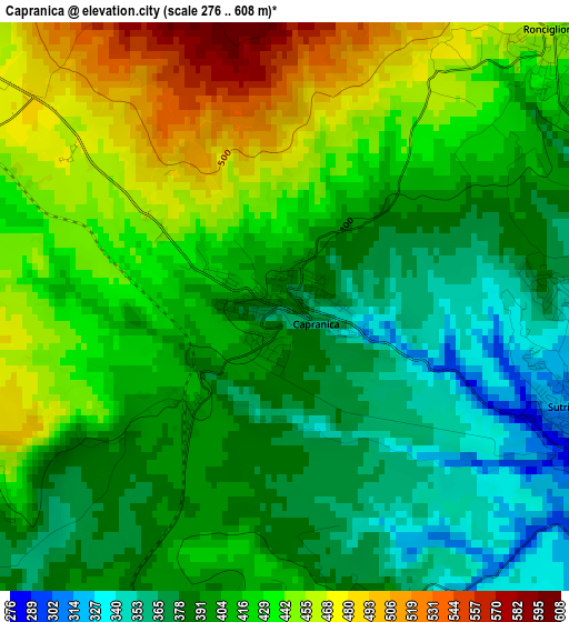
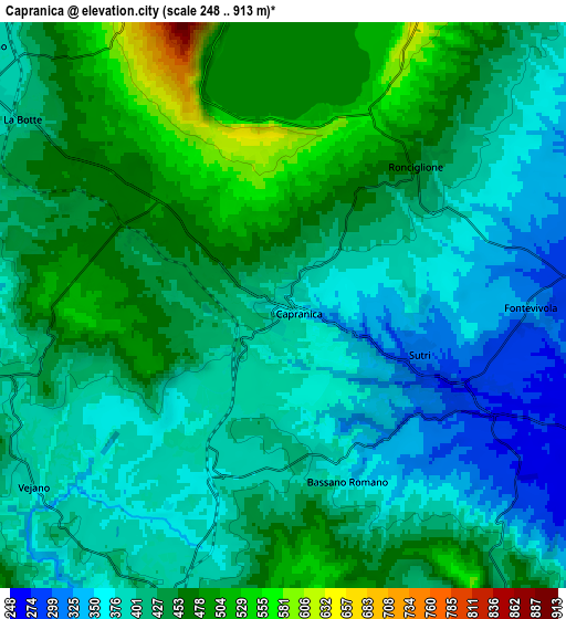
Below is the Elevation map of Capranica, which displays elevation range with different colors. Scale of the first map is from 276 to 608 m (906 to 1995 ft) with average elevation of 413 meters (=1355 ft) [note 1]
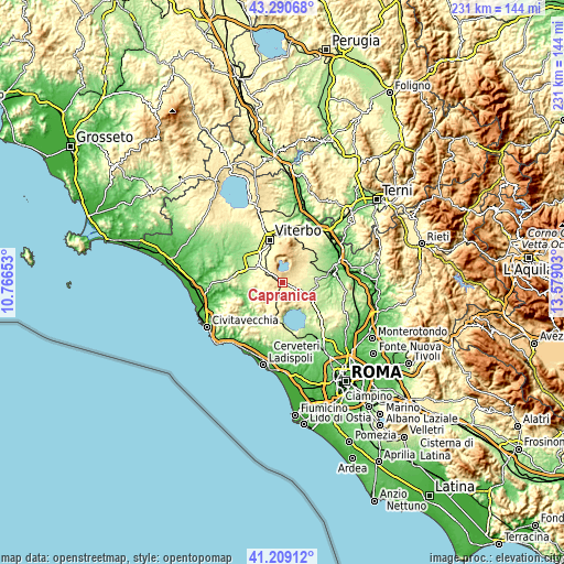
These maps also provides idea of topography and contour of this city, they are displayed at different zoom levels. More info about maps, scale and edge coordinates you can find below images.
| \ | Map #1 | Map #2 | Topo.Map |
| Scale [m] | 276..608 m | 248..913 m | × |
| Scale [ft] | 906..1995 ft | 814..2995 ft | × |
| Average | 413 m = 1355 ft | 422.6 m = 1386 ft | × |
| Width | 7.23 km = 4.5 mi | 14.47 km = 9 mi | 231.4 km = 143.8 mi |
| Height | 7.23 km = 4.5 mi | 14.47 km = 9 mi | 231.4 km = 143.8 mi |
| ↑Max Latitude | 42.291006° | 42.323506° | 43.29068° |
| Latitude at center | 42.25849° | 42.25849° | 42.25849° |
| ↓Min Latitude | 42.225957° | 42.193407° | 41.20912° |
| ← Min Longitude | 12.128835° | 12.084889° | 10.76653° |
| Longitude center | 12.17278° | 12.17278° | 12.17278° |
| →Max Longitude | 12.216725° | 12.260671° | 13.57903° |
Nearby cities:
Cities around Capranica sort by population:
• Vetralla elevation 364 m
10.5 km,  308°
308°
• Ronciglione 450 m
4.8 km,  45°
45°
• Sutri 311 m
3.9 km,  110°
110°
• Caprarola 482 m
9 km,  36°
36°
• Bassano Romano 374 m
4.2 km,  162°
162°
• Trevignano Romano 174 m
12.2 km,  153°
153°
• Oriolo Romano 415 m
11 km,  194°
194°
• Blera 287 m
11.8 km,  277°
277°
• Carbognano 396 m
11 km, 43°
• Vejano 399 m
7.8 km,  235°
235°
• Villa San Giovanni in Tuscia 333 m
10.1 km, 282°
• Barbarano Romano 341 m
8.7 km,  263°
263°
Multilingual:
 En español:
Capranica elevación 386 m.
 En France:
Capranica élévation 386 m.
 Auf Deutsch:
Capranica höhe über dem Meeresspiegel ist 386 m.

Sources and notes:
- [note 1] Map square and city borders are not equal. Map elevation data is calculated only from area inside that square.
- [src 1] Elevation data from geonames database provided with same terms of usage.
- [src 2] The elevation map of Capranica is generated using elevation data from NASA's 3 arcsec (90m) resolution SRTM data.
- [src 3] Base (background) map © OpenStreetMap contributors tiles are generated by Geofabrik and OpenTopoMap.
Copyright & License:
This Capranica Elevation Map is licensed under CC BY-SA. You may reuse any part from this page, if you give a proper credit by linking to this URL:
 More info on terms of use page.