Capurso elevation
Capurso (Apulia, Bari), Italy elevation is 77 meters and Capurso elevation in feet is 253 ft above sea level [src 1]. Capurso is a seat of a third-order administrative division (feature code) with elevation that is 245 meters (804 ft) smaller than average city elevation in Italy.
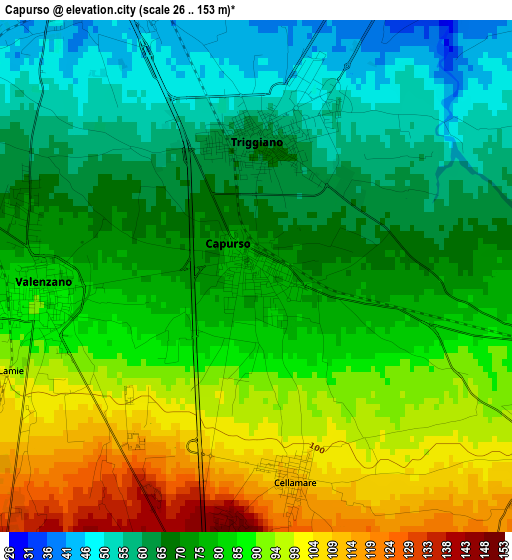
Below is the Elevation map of Capurso, which displays elevation range with different colors. Scale of the first map is from 26 to 153 m (85 to 502 ft) with average elevation of 78.5 meters (=258 ft) [note 1]
These maps also provides idea of topography and contour of this city, they are displayed at different zoom levels. More info about maps, scale and edge coordinates you can find below images.
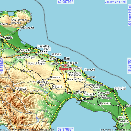
| \ | Map #1 | Map #2 | Topo.Map |
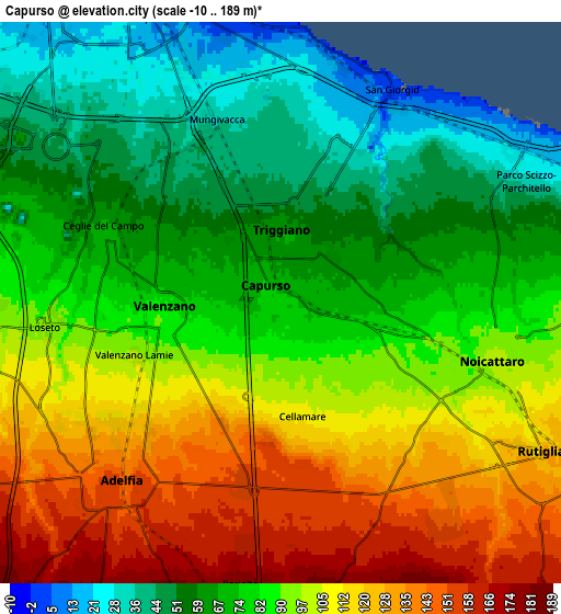
| Scale [m] | 26..153 m | -10..189 m | × |
| Scale [ft] | 85..502 ft | -33..620 ft | × |
| Average | 78.5 m = 258 ft | 88.2 m = 289 ft | × |
| Width | 7.37 km = 4.6 mi | 14.74 km = 9.2 mi | 235.8 km = 146.5 mi |
| Height | 7.37 km = 4.6 mi | 14.74 km = 9.2 mi | 235.8 km = 146.5 mi |
| ↑Max Latitude | 41.079114° | 41.112232° | 42.09799° |
| Latitude at center | 41.04598° | 41.04598° | 41.04598° |
| ↓Min Latitude | 41.012829° | 40.979661° | 39.97688° |
| ← Min Longitude | 16.877735° | 16.833789° | 15.51543° |
| Longitude center | 16.92168° | 16.92168° | 16.92168° |
| →Max Longitude | 16.965625° | 17.009571° | 18.32793° |
Nearby cities:
Cities around Capurso sort by population:
• Bari elevation 5 m
9.4 km,  332°
332°
• Triggiano 57 m
2.2 km,  7°
7°
• Noicattaro 100 m
5.8 km,  102°
102°
• Casamassima 222 m
9.9 km,  180°
180°
• Rutigliano 133 m
8.1 km,  119°
119°
• Adelfia 151 m
6.3 km,  221°
221°
• Valenzano 84 m
3.1 km,  265°
265°
• Bitritto 99 m
8 km, 267°
• Cellamare 110 m
3 km,  170°
170°
• Loseto 92 m
6.1 km, 265°
• Parco Scizzo-Parchitello 39 m
6.8 km,  62°
62°
• Lamie 102 m
4.1 km,  250°
250°
Multilingual:
 En español:
Capurso elevación 77 m.
 En France:
Capurso élévation 77 m.


Sources and notes:
- [note 1] Map square and city borders are not equal. Map elevation data is calculated only from area inside that square.
- [src 1] Elevation data from geonames database provided with same terms of usage.
- [src 2] The elevation map of Capurso is generated using elevation data from NASA's 3 arcsec (90m) resolution SRTM data.
- [src 3] Base (background) map © OpenStreetMap contributors tiles are generated by Geofabrik and OpenTopoMap.
Copyright & License:
This Capurso Elevation Map is licensed under CC BY-SA. You may reuse any part from this page, if you give a proper credit by linking to this URL:
 More info on terms of use page.