Loseto elevation
Loseto (Apulia, Bari), Italy elevation is 92 meters and Loseto elevation in feet is 302 ft above sea level [src 1]. Loseto is a populated place (feature code) with elevation that is 230 meters (755 ft) smaller than average city elevation in Italy.
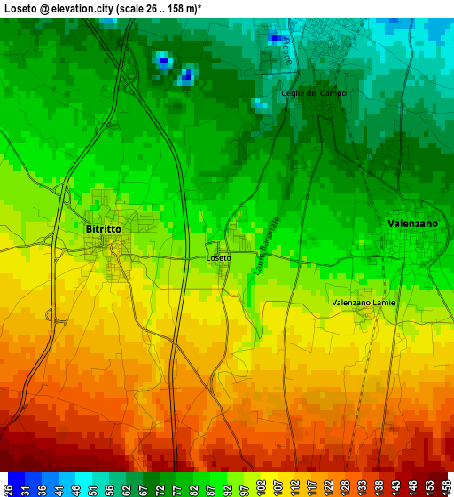
Below is the Elevation map of Loseto, which displays elevation range with different colors. Scale of the first map is from 26 to 158 m (85 to 518 ft) with average elevation of 95.3 meters (=313 ft) [note 1]
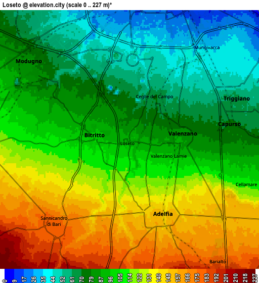
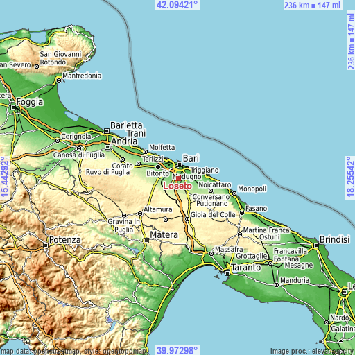
These maps also provides idea of topography and contour of this city, they are displayed at different zoom levels. More info about maps, scale and edge coordinates you can find below images.
| \ | Map #1 | Map #2 | Topo.Map |
| Scale [m] | 26..158 m | 0..227 m | × |
| Scale [ft] | 85..518 ft | 0..745 ft | × |
| Average | 95.3 m = 313 ft | 102.3 m = 336 ft | × |
| Width | 7.37 km = 4.6 mi | 14.74 km = 9.2 mi | 235.9 km = 146.6 mi |
| Height | 7.37 km = 4.6 mi | 14.74 km = 9.2 mi | 235.9 km = 146.6 mi |
| ↑Max Latitude | 41.075276° | 41.108396° | 42.09421° |
| Latitude at center | 41.04214° | 41.04214° | 41.04214° |
| ↓Min Latitude | 41.008987° | 40.975817° | 39.97298° |
| ← Min Longitude | 16.805225° | 16.761279° | 15.44292° |
| Longitude center | 16.84917° | 16.84917° | 16.84917° |
| →Max Longitude | 16.893115° | 16.937061° | 18.25542° |
Nearby cities:
Cities around Loseto sort by population:
• Bari elevation 5 m
8.9 km,  11°
11°
• Modugno 79 m
7.2 km,  310°
310°
• San Paolo 35 m
10.3 km,  332°
332°
• Triggiano 57 m
6.9 km,  67°
67°
• Adelfia 151 m
4.7 km,  156°
156°
• Valenzano 84 m
3 km,  86°
86°
• Capurso 77 m
6.1 km, 85°
• Bitetto 139 m
8.5 km,  269°
269°
• Bitritto 99 m
1.9 km, 274°
• Sannicandro di Bari 180 m
6.4 km,  223°
223°
• Cellamare 110 m
7 km,  110°
110°
• Lamie 102 m
2.4 km, 113°
Multilingual:
 En español:
Loseto elevación 92 m.
 En France:
Loseto élévation 92 m.


Sources and notes:
- [note 1] Map square and city borders are not equal. Map elevation data is calculated only from area inside that square.
- [src 1] Elevation data from geonames database provided with same terms of usage.
- [src 2] The elevation map of Loseto is generated using elevation data from NASA's 3 arcsec (90m) resolution SRTM data.
- [src 3] Base (background) map © OpenStreetMap contributors tiles are generated by Geofabrik and OpenTopoMap.
Copyright & License:
This Loseto Elevation Map is licensed under CC BY-SA. You may reuse any part from this page, if you give a proper credit by linking to this URL:
 More info on terms of use page.