Casalvieri elevation
Casalvieri (Latium, Provincia di Frosinone), Italy elevation is 351 meters and Casalvieri elevation in feet is 1152 ft above sea level [src 1]. Casalvieri is a seat of a third-order administrative division (feature code) with elevation that is 29 meters (95 ft) bigger than average city elevation in Italy.
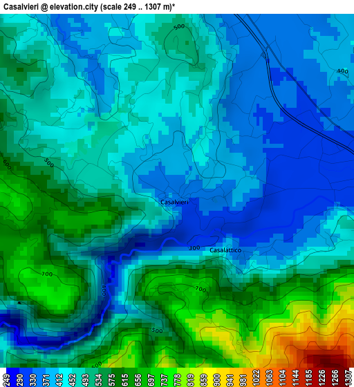
Below is the Elevation map of Casalvieri, which displays elevation range with different colors. Scale of the first map is from 249 to 1307 m (817 to 4288 ft) with average elevation of 489.5 meters (=1606 ft) [note 1]
These maps also provides idea of topography and contour of this city, they are displayed at different zoom levels. More info about maps, scale and edge coordinates you can find below images.
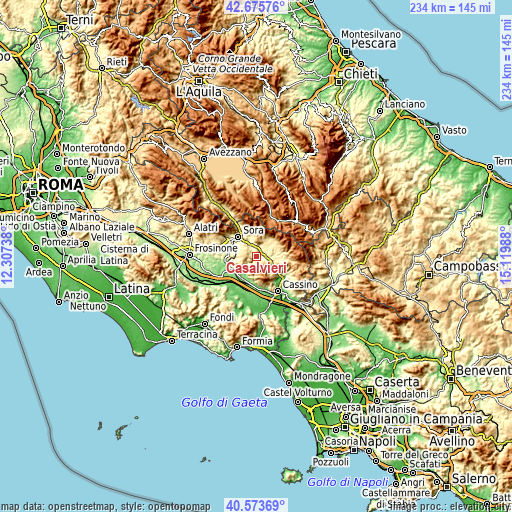
| \ | Map #1 | Topo.Map |
| Scale [m] | 249..1307 m | × |
| Scale [ft] | 817..4288 ft | × |
| Average | 489.5 m = 1606 ft | × |
| Width | 7.3 km = 4.5 mi | 233.7 km = 145.2 mi |
| Height | 7.3 km = 4.5 mi | 233.7 km = 145.2 mi |
| ↑Max Latitude | 41.666127° | 42.67576° |
| Latitude at center | 41.63329° | 41.63329° |
| ↓Min Latitude | 41.600436° | 40.57369° |
| ← Min Longitude | 13.669685° | 12.30738° |
| Longitude center | 13.71363° | 13.71363° |
| →Max Longitude | 13.757575° | 15.11988° |
Nearby cities:
Cities around Casalvieri sort by population:
• Arpino elevation 429 m
8.6 km,  280°
280°
• Broccostella 300 m
9.8 km,  318°
318°
• Atina Inferiore 355 m
6.6 km,  96°
96°
• Alvito 482 m
6.9 km,  24°
24°
• Atina 473 m
7.3 km, 101°
• Posta Fibreno 320 m
7.1 km,  336°
336°
• Vicalvi 427 m
5 km,  354°
354°
• Colle San Magno 536 m
9.4 km,  189°
189°
• Santopadre 728 m
7.4 km,  241°
241°
• Fontechiari 386 m
5 km, 320°
• Gallinaro 524 m
7.4 km,  70°
70°
• Casalattico 404 m
1.6 km,  141°
141°
Multilingual:
 En español:
Casalvieri elevación 351 m.
 En France:
Casalvieri élévation 351 m.
 Auf Deutsch:
Casalvieri höhe über dem Meeresspiegel ist 351 m.

Sources and notes:
- [note 1] Map square and city borders are not equal. Map elevation data is calculated only from area inside that square.
- [src 1] Elevation data from geonames database provided with same terms of usage.
- [src 2] The elevation map of Casalvieri is generated using elevation data from NASA's 3 arcsec (90m) resolution SRTM data.
- [src 3] Base (background) map © OpenStreetMap contributors tiles are generated by Geofabrik and OpenTopoMap.
Copyright & License:
This Casalvieri Elevation Map is licensed under CC BY-SA. You may reuse any part from this page, if you give a proper credit by linking to this URL:
 More info on terms of use page.