Gallinaro elevation
Gallinaro (Latium, Provincia di Frosinone), Italy elevation is 524 meters and Gallinaro elevation in feet is 1719 ft above sea level [src 1]. Gallinaro is a seat of a third-order administrative division (feature code) with elevation that is 202 meters (663 ft) bigger than average city elevation in Italy.
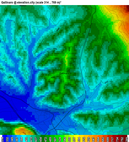
Below is the Elevation map of Gallinaro, which displays elevation range with different colors. Scale of the first map is from 314 to 769 m (1030 to 2523 ft) with average elevation of 423.4 meters (=1389 ft) [note 1]
These maps also provides idea of topography and contour of this city, they are displayed at different zoom levels. More info about maps, scale and edge coordinates you can find below images.
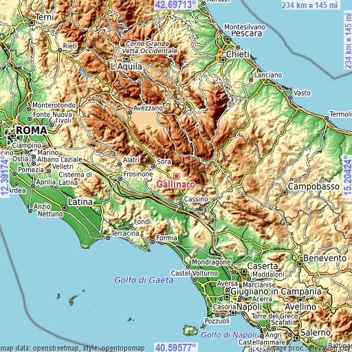
| \ | Map #1 | Topo.Map |
| Scale [m] | 314..769 m | × |
| Scale [ft] | 1030..2523 ft | × |
| Average | 423.4 m = 1389 ft | × |
| Width | 7.3 km = 4.5 mi | 233.6 km = 145.2 mi |
| Height | 7.3 km = 4.5 mi | 233.6 km = 145.2 mi |
| ↑Max Latitude | 41.687846° | 42.69713° |
| Latitude at center | 41.65502° | 41.65502° |
| ↓Min Latitude | 41.622177° | 40.59577° |
| ← Min Longitude | 13.754045° | 12.39174° |
| Longitude center | 13.79799° | 13.79799° |
| →Max Longitude | 13.841935° | 15.20424° |
Nearby cities:
Cities around Gallinaro sort by population:
• Atina Inferiore elevation 355 m
3.1 km,  188°
188°
• San Donato Val di Comino 650 m
5.9 km,  11°
11°
• Alvito 482 m
5.7 km,  313°
313°
• Villa Latina 423 m
5.4 km,  144°
144°
• Atina 473 m
3.9 km,  178°
178°
• Vicalvi 427 m
7.9 km,  288°
288°
• Casalvieri 351 m
7.4 km,  250°
250°
• Belmonte Castello 306 m
8.8 km,  170°
170°
• Picinisco 700 m
5.9 km,  100°
100°
• Fontechiari 386 m
10.3 km,  277°
277°
• Settefrati 779 m
4.7 km,  68°
68°
• Casalattico 404 m
7 km,  238°
238°
Multilingual:
 En español:
Gallinaro elevación 524 m.
 En France:
Gallinaro élévation 524 m.
 Auf Deutsch:
Gallinaro höhe über dem Meeresspiegel ist 524 m.

Sources and notes:
- [note 1] Map square and city borders are not equal. Map elevation data is calculated only from area inside that square.
- [src 1] Elevation data from geonames database provided with same terms of usage.
- [src 2] The elevation map of Gallinaro is generated using elevation data from NASA's 3 arcsec (90m) resolution SRTM data.
- [src 3] Base (background) map © OpenStreetMap contributors tiles are generated by Geofabrik and OpenTopoMap.
Copyright & License:
This Gallinaro Elevation Map is licensed under CC BY-SA. You may reuse any part from this page, if you give a proper credit by linking to this URL:
 More info on terms of use page.