Castelnuovo Rangone elevation
Castelnuovo Rangone (Emilia-Romagna, Provincia di Modena), Italy elevation is 74 meters and Castelnuovo Rangone elevation in feet is 243 ft above sea level [src 1]. Castelnuovo Rangone is a seat of a third-order administrative division (feature code) with elevation that is 248 meters (814 ft) smaller than average city elevation in Italy.
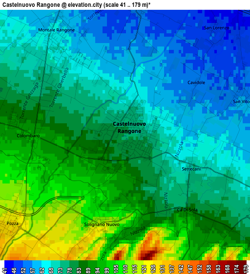
Below is the Elevation map of Castelnuovo Rangone, which displays elevation range with different colors. Scale of the first map is from 41 to 179 m (135 to 587 ft) with average elevation of 79.7 meters (=261 ft) [note 1]
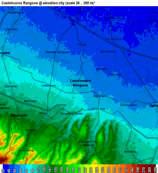
These maps also provides idea of topography and contour of this city, they are displayed at different zoom levels. More info about maps, scale and edge coordinates you can find below images.
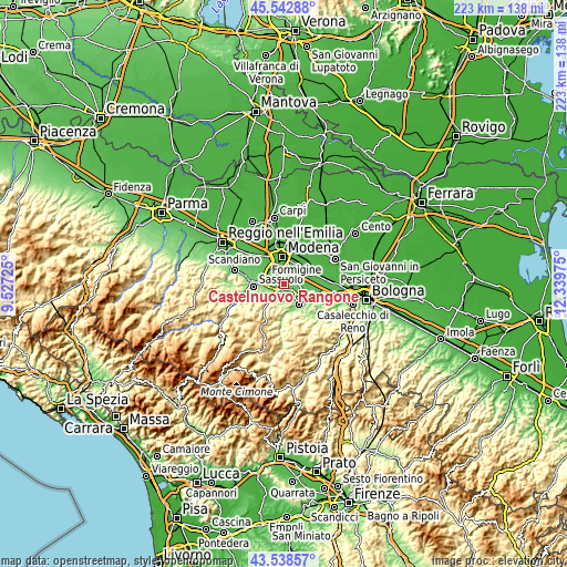
| \ | Map #1 | Map #2 | Topo.Map |
| Scale [m] | 41..179 m | 26..399 m | × |
| Scale [ft] | 135..587 ft | 85..1309 ft | × |
| Average | 79.7 m = 261 ft | 92.4 m = 303 ft | × |
| Width | 6.96 km = 4.3 mi | 13.93 km = 8.7 mi | 222.9 km = 138.5 mi |
| Height | 6.96 km = 4.3 mi | 13.93 km = 8.7 mi | 222.8 km = 138.4 mi |
| ↑Max Latitude | 44.580659° | 44.611951° | 45.54288° |
| Latitude at center | 44.54935° | 44.54935° | 44.54935° |
| ↓Min Latitude | 44.518024° | 44.486681° | 43.53857° |
| ← Min Longitude | 10.889555° | 10.845609° | 9.52725° |
| Longitude center | 10.9335° | 10.9335° | 10.9335° |
| →Max Longitude | 10.977445° | 11.021391° | 12.33975° |
Nearby cities:
Cities around Castelnuovo Rangone sort by population:
• Formigine elevation 82 m
7.3 km,  290°
290°
• Maranello 129 m
5.5 km,  248°
248°
• Spilamberto 69 m
6.9 km,  105°
105°
• Montale 67 m
3 km,  317°
317°
• Castelvetro di Modena 120 m
5.1 km,  168°
168°
• Pozza 126 m
4.1 km,  231°
231°
• San Damaso 41 m
6.6 km,  29°
29°
• Solignano Nuovo 118 m
2.5 km,  193°
193°
• Gorzano 147 m
5.6 km, 229°
• Colombaro 91 m
3 km,  274°
274°
• San Vito 57 m
3.4 km,  73°
73°
• Ca' di Sola 92 m
2.7 km,  142°
142°
Multilingual:
 En español:
Castelnuovo Rangone elevación 74 m.
 En France:
Castelnuovo Rangone élévation 74 m.
 Auf Deutsch:
Castelnuovo Rangone höhe über dem Meeresspiegel ist 74 m.
 На русском:
Castelnuovo Rangone высота над уровнем моря 74 м
Sources and notes:
- [note 1] Map square and city borders are not equal. Map elevation data is calculated only from area inside that square.
- [src 1] Elevation data from geonames database provided with same terms of usage.
- [src 2] The elevation map of Castelnuovo Rangone is generated using elevation data from NASA's 3 arcsec (90m) resolution SRTM data.
- [src 3] Base (background) map © OpenStreetMap contributors tiles are generated by Geofabrik and OpenTopoMap.
Copyright & License:
This Castelnuovo Rangone Elevation Map is licensed under CC BY-SA. You may reuse any part from this page, if you give a proper credit by linking to this URL:
 More info on terms of use page.