Cavriana elevation
Cavriana (Lombardy, Provincia di Mantova), Italy elevation is 147 meters and Cavriana elevation in feet is 482 ft above sea level [src 1]. Cavriana is a seat of a third-order administrative division (feature code) with elevation that is 175 meters (574 ft) smaller than average city elevation in Italy.
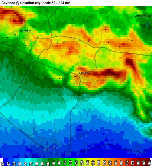
Below is the Elevation map of Cavriana, which displays elevation range with different colors. Scale of the first map is from 52 to 194 m (171 to 636 ft) with average elevation of 102.7 meters (=337 ft) [note 1]
These maps also provides idea of topography and contour of this city, they are displayed at different zoom levels. More info about maps, scale and edge coordinates you can find below images.
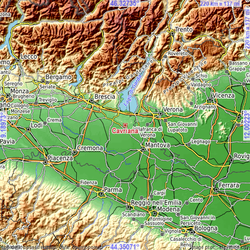
| \ | Map #1 | Topo.Map |
| Scale [m] | 52..194 m | × |
| Scale [ft] | 171..636 ft | × |
| Average | 102.7 m = 337 ft | × |
| Width | 6.87 km = 4.3 mi | 219.8 km = 136.6 mi |
| Height | 6.87 km = 4.3 mi | 219.8 km = 136.6 mi |
| ↑Max Latitude | 45.378536° | 46.32735° |
| Latitude at center | 45.34766° | 45.34766° |
| ↓Min Latitude | 45.316767° | 44.35071° |
| ← Min Longitude | 10.552035° | 9.18973° |
| Longitude center | 10.59598° | 10.59598° |
| →Max Longitude | 10.639925° | 12.00223° |
Nearby cities:
Cities around Cavriana sort by population:
• Castiglione delle Stiviere elevation 100 m
9.8 km,  298°
298°
• Valeggio sul Mincio 90 m
11 km,  86°
86°
• Guidizzolo 64 m
3.3 km,  204°
204°
• Volta Mantovana 109 m
5.7 km,  120°
120°
• Medole 61 m
6.9 km,  249°
249°
• Monzambano 79 m
8.7 km,  61°
61°
• Pozzolengo 117 m
6.9 km,  22°
22°
• Solferino 135 m
3.6 km,  319°
319°
• San Martino della Battaglia 83 m
10.1 km,  2°
2°
• Ceresara 44 m
9.7 km,  192°
192°
• Cerlongo 43 m
8.8 km,  151°
151°
• Ponti sul Mincio 97 m
10 km,  44°
44°
Multilingual:
 En español:
Cavriana elevación 147 m.
 En France:
Cavriana élévation 147 m.
 Auf Deutsch:
Cavriana höhe über dem Meeresspiegel ist 147 m.

Sources and notes:
- [note 1] Map square and city borders are not equal. Map elevation data is calculated only from area inside that square.
- [src 1] Elevation data from geonames database provided with same terms of usage.
- [src 2] The elevation map of Cavriana is generated using elevation data from NASA's 3 arcsec (90m) resolution SRTM data.
- [src 3] Base (background) map © OpenStreetMap contributors tiles are generated by Geofabrik and OpenTopoMap.
Copyright & License:
This Cavriana Elevation Map is licensed under CC BY-SA. You may reuse any part from this page, if you give a proper credit by linking to this URL:
 More info on terms of use page.