Cerlongo elevation
Cerlongo (Lombardy, Provincia di Mantova), Italy elevation is 43 meters and Cerlongo elevation in feet is 141 ft above sea level [src 1]. Cerlongo is a populated place (feature code) with elevation that is 279 meters (915 ft) smaller than average city elevation in Italy.
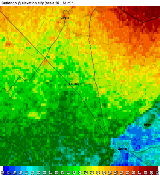
Below is the Elevation map of Cerlongo, which displays elevation range with different colors. Scale of the first map is from 26 to 61 m (85 to 200 ft) with average elevation of 43.4 meters (=142 ft) [note 1]
These maps also provides idea of topography and contour of this city, they are displayed at different zoom levels. More info about maps, scale and edge coordinates you can find below images.
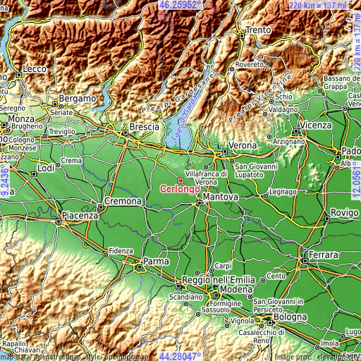
| \ | Map #1 | Topo.Map |
| Scale [m] | 26..61 m | × |
| Scale [ft] | 85..200 ft | × |
| Average | 43.4 m = 142 ft | × |
| Width | 6.88 km = 4.3 mi | 220 km = 136.7 mi |
| Height | 6.88 km = 4.3 mi | 220 km = 136.7 mi |
| ↑Max Latitude | 45.309534° | 46.25952° |
| Latitude at center | 45.27862° | 45.27862° |
| ↓Min Latitude | 45.247689° | 44.28047° |
| ← Min Longitude | 10.605905° | 9.2436° |
| Longitude center | 10.64985° | 10.64985° |
| →Max Longitude | 10.693795° | 12.0561° |
Nearby cities:
Cities around Cerlongo sort by population:
• Valeggio sul Mincio elevation 90 m
10.7 km,  39°
39°
• Goito 38 m
3.2 km,  163°
163°
• Marmirolo 29 m
10.6 km,  128°
128°
• Guidizzolo 64 m
7.3 km,  309°
309°
• Volta Mantovana 109 m
4.9 km,  8°
8°
• Roverbella 41 m
9.5 km,  98°
98°
• Gazoldo degli Ippoliti 36 m
10.4 km,  212°
212°
• Cavriana 147 m
8.8 km,  331°
331°
• Rodigo 35 m
9 km,  192°
192°
• Ceresara 44 m
6.5 km,  253°
253°
• Soave 24 m
10.9 km,  148°
148°
• Piubega 40 m
10.9 km,  238°
238°
Multilingual:
 En español:
Cerlongo elevación 43 m.
 En France:
Cerlongo élévation 43 m.


Sources and notes:
- [note 1] Map square and city borders are not equal. Map elevation data is calculated only from area inside that square.
- [src 1] Elevation data from geonames database provided with same terms of usage.
- [src 2] The elevation map of Cerlongo is generated using elevation data from NASA's 3 arcsec (90m) resolution SRTM data.
- [src 3] Base (background) map © OpenStreetMap contributors tiles are generated by Geofabrik and OpenTopoMap.
Copyright & License:
This Cerlongo Elevation Map is licensed under CC BY-SA. You may reuse any part from this page, if you give a proper credit by linking to this URL:
 More info on terms of use page.