Cerasolo elevation
Cerasolo (Emilia-Romagna, Provincia di Rimini), Italy elevation is 57 meters and Cerasolo elevation in feet is 187 ft above sea level [src 1]. Cerasolo is a populated place (feature code) with elevation that is 265 meters (869 ft) smaller than average city elevation in Italy.
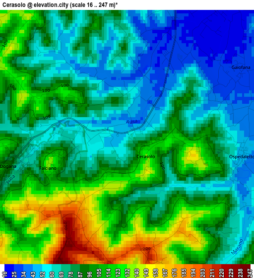
Below is the Elevation map of Cerasolo, which displays elevation range with different colors. Scale of the first map is from 16 to 247 m (52 to 810 ft) with average elevation of 87.3 meters (=286 ft) [note 1]
These maps also provides idea of topography and contour of this city, they are displayed at different zoom levels. More info about maps, scale and edge coordinates you can find below images.
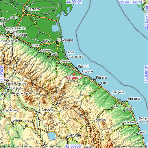
| \ | Map #1 | Topo.Map |
| Scale [m] | 16..247 m | × |
| Scale [ft] | 52..810 ft | × |
| Average | 87.3 m = 286 ft | × |
| Width | 7.03 km = 4.4 mi | 225 km = 139.8 mi |
| Height | 7.03 km = 4.4 mi | 225 km = 139.8 mi |
| ↑Max Latitude | 44.01966° | 44.9912° |
| Latitude at center | 43.98805° | 43.98805° |
| ↓Min Latitude | 43.956424° | 42.96766° |
| ← Min Longitude | 12.485935° | 11.12363° |
| Longitude center | 12.52988° | 12.52988° |
| →Max Longitude | 12.573825° | 13.93613° |
Nearby cities:
Cities around Cerasolo sort by population:
• Rimini elevation 10 m
8.2 km,  20°
20°
• Rivazzurra 5 m
8.7 km,  46°
46°
• Villa Verucchio 85 m
7.8 km,  284°
284°
• Coriano 77 m
6 km,  110°
110°
• Santa Giustina 28 m
9.6 km,  337°
337°
• Corpolò 65 m
7.1 km,  299°
299°
• San Martino dei Mulini 46 m
7.2 km,  312°
312°
• Trarivi 204 m
5.8 km,  168°
168°
• Ospedaletto 45 m
3.3 km,  98°
98°
• Montescudo 347 m
7.9 km, 173°
• Verucchio 331 m
8.6 km,  265°
265°
• Monte Colombo 312 m
7.8 km, 166°
Multilingual:
 En español:
Cerasolo elevación 57 m.
 En France:
Cerasolo élévation 57 m.


Sources and notes:
- [note 1] Map square and city borders are not equal. Map elevation data is calculated only from area inside that square.
- [src 1] Elevation data from geonames database provided with same terms of usage.
- [src 2] The elevation map of Cerasolo is generated using elevation data from NASA's 3 arcsec (90m) resolution SRTM data.
- [src 3] Base (background) map © OpenStreetMap contributors tiles are generated by Geofabrik and OpenTopoMap.
Copyright & License:
This Cerasolo Elevation Map is licensed under CC BY-SA. You may reuse any part from this page, if you give a proper credit by linking to this URL:
 More info on terms of use page.