Trarivi elevation
Trarivi (Emilia-Romagna, Provincia di Rimini), Italy elevation is 204 meters and Trarivi elevation in feet is 669 ft above sea level [src 1]. Trarivi is a populated place (feature code) with elevation that is 118 meters (387 ft) smaller than average city elevation in Italy.
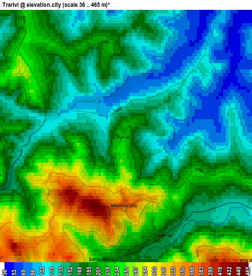
Below is the Elevation map of Trarivi, which displays elevation range with different colors. Scale of the first map is from 36 to 465 m (118 to 1526 ft) with average elevation of 180.7 meters (=593 ft) [note 1]
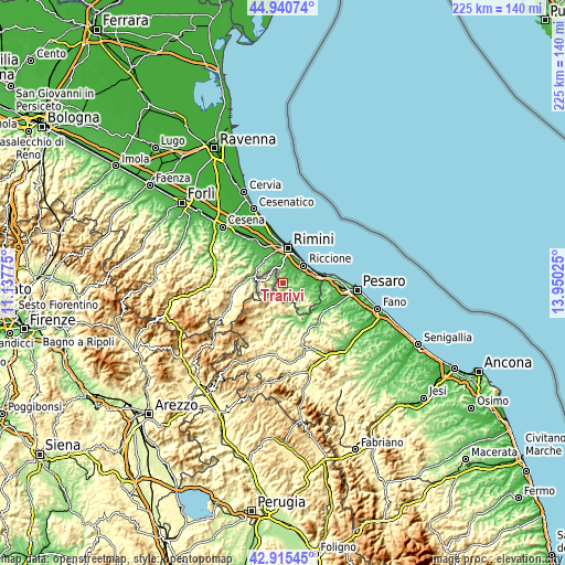
These maps also provides idea of topography and contour of this city, they are displayed at different zoom levels. More info about maps, scale and edge coordinates you can find below images.
| \ | Map #1 | Topo.Map |
| Scale [m] | 36..465 m | × |
| Scale [ft] | 118..1526 ft | × |
| Average | 180.7 m = 593 ft | × |
| Width | 7.04 km = 4.4 mi | 225.2 km = 139.9 mi |
| Height | 7.04 km = 4.4 mi | 225.2 km = 139.9 mi |
| ↑Max Latitude | 43.968357° | 44.94074° |
| Latitude at center | 43.93672° | 43.93672° |
| ↓Min Latitude | 43.905066° | 42.91545° |
| ← Min Longitude | 12.500055° | 11.13775° |
| Longitude center | 12.544° | 12.544° |
| →Max Longitude | 12.587945° | 13.95025° |
Nearby cities:
Cities around Trarivi sort by population:
• Morciano di Romagna elevation 80 m
8.9 km,  106°
106°
• Coriano 77 m
5.8 km,  51°
51°
• Sant'Andrea in Casale 86 m
8.5 km,  92°
92°
• Cerasolo 57 m
5.8 km,  348°
348°
• Ospedaletto 45 m
5.6 km,  22°
22°
• Montescudo 347 m
2.1 km,  186°
186°
• Mercatino Conca 284 m
8.5 km,  209°
209°
• San Clemente 172 m
6.7 km, 93°
• Gemmano 380 m
4.7 km,  140°
140°
• Montefiore Conca 368 m
7.6 km,  134°
134°
• Sassofeltrio 459 m
5.7 km, 208°
• Monte Colombo 312 m
2 km,  160°
160°
Multilingual:
 En español:
Trarivi elevación 204 m.
 En France:
Trarivi élévation 204 m.


Sources and notes:
- [note 1] Map square and city borders are not equal. Map elevation data is calculated only from area inside that square.
- [src 1] Elevation data from geonames database provided with same terms of usage.
- [src 2] The elevation map of Trarivi is generated using elevation data from NASA's 3 arcsec (90m) resolution SRTM data.
- [src 3] Base (background) map © OpenStreetMap contributors tiles are generated by Geofabrik and OpenTopoMap.
Copyright & License:
This Trarivi Elevation Map is licensed under CC BY-SA. You may reuse any part from this page, if you give a proper credit by linking to this URL:
 More info on terms of use page.