Ceriana elevation
Ceriana (Liguria, Provincia di Imperia), Italy elevation is 350 meters and Ceriana elevation in feet is 1148 ft above sea level [src 1]. Ceriana is a seat of a third-order administrative division (feature code) with elevation that is 28 meters (92 ft) bigger than average city elevation in Italy.
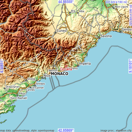
Below is the Elevation map of Ceriana, which displays elevation range with different colors. Scale of the first map is from 81 to 1288 m (266 to 4226 ft) with average elevation of 671.7 meters (=2204 ft) [note 1]
These maps also provides idea of topography and contour of this city, they are displayed at different zoom levels. More info about maps, scale and edge coordinates you can find below images.

| \ | Map #1 | Topo.Map |
| Scale [m] | 81..1288 m | × |
| Scale [ft] | 266..4226 ft | × |
| Average | 671.7 m = 2204 ft | × |
| Width | 7.04 km = 4.4 mi | 225.4 km = 140.1 mi |
| Height | 7.04 km = 4.4 mi | 225.4 km = 140.1 mi |
| ↑Max Latitude | 43.912577° | 44.88588° |
| Latitude at center | 43.88091° | 43.88091° |
| ↓Min Latitude | 43.849227° | 42.85869° |
| ← Min Longitude | 7.730815° | 6.36851° |
| Longitude center | 7.77476° | 7.77476° |
| →Max Longitude | 7.818705° | 9.18101° |
Nearby cities:
Cities around Ceriana sort by population:
• San Remo elevation 22 m
7.1 km,  178°
178°
• Taggia 24 m
7.3 km,  121°
121°
• Riva Ligure 13 m
9.6 km, 119°
• Badalucco 185 m
7 km,  54°
54°
• Pompeiana 172 m
9.6 km,  108°
108°
• Perinaldo 535 m
8.4 km,  259°
259°
• Castellaro 242 m
7.8 km,  103°
103°
• Apricale 254 m
9.2 km,  269°
269°
• Castel Vittorio 429 m
9.5 km,  302°
302°
• Montalto Ligure 318 m
7.7 km, 46°
• Bajardo 891 m
4.7 km, 302°
• Seborga 507 m
8.7 km,  226°
226°
Multilingual:
 En español:
Ceriana elevación 350 m.
 En France:
Ceriana élévation 350 m.


Sources and notes:
- [note 1] Map square and city borders are not equal. Map elevation data is calculated only from area inside that square.
- [src 1] Elevation data from geonames database provided with same terms of usage.
- [src 2] The elevation map of Ceriana is generated using elevation data from NASA's 3 arcsec (90m) resolution SRTM data.
- [src 3] Base (background) map © OpenStreetMap contributors tiles are generated by Geofabrik and OpenTopoMap.
Copyright & License:
This Ceriana Elevation Map is licensed under CC BY-SA. You may reuse any part from this page, if you give a proper credit by linking to this URL:
 More info on terms of use page.