Cervere elevation
Cervere (Piedmont, Provincia di Cuneo), Italy elevation is 310 meters and Cervere elevation in feet is 1017 ft above sea level [src 1]. Cervere is a seat of a third-order administrative division (feature code) with elevation that is 12 meters (39 ft) smaller than average city elevation in Italy.
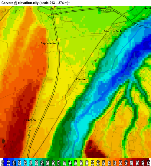
Below is the Elevation map of Cervere, which displays elevation range with different colors. Scale of the first map is from 213 to 374 m (699 to 1227 ft) with average elevation of 300.4 meters (=986 ft) [note 1]
These maps also provides idea of topography and contour of this city, they are displayed at different zoom levels. More info about maps, scale and edge coordinates you can find below images.
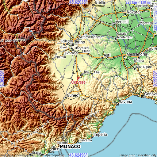
| \ | Map #1 | Topo.Map |
| Scale [m] | 213..374 m | × |
| Scale [ft] | 699..1227 ft | × |
| Average | 300.4 m = 986 ft | × |
| Width | 6.95 km = 4.3 mi | 222.5 km = 138.3 mi |
| Height | 6.95 km = 4.3 mi | 222.5 km = 138.3 mi |
| ↑Max Latitude | 44.665543° | 45.62635° |
| Latitude at center | 44.63428° | 44.63428° |
| ↓Min Latitude | 44.603° | 43.62496° |
| ← Min Longitude | 7.744895° | 6.38259° |
| Longitude center | 7.78884° | 7.78884° |
| →Max Longitude | 7.832785° | 9.19509° |
Nearby cities:
Cities around Cervere sort by population:
• Bra elevation 283 m
8.6 km,  34°
34°
• Fossano 357 m
10.8 km,  210°
210°
• Savigliano 316 m
10.6 km,  278°
278°
• Cherasco 289 m
5.6 km,  79°
79°
• Marene 314 m
5.2 km,  304°
304°
• Bandito 283 m
10.2 km,  15°
15°
• Roreto 288 m
5.3 km,  42°
42°
• Bene Vagienna 352 m
10.6 km,  163°
163°
• Narzole 328 m
7.7 km,  125°
125°
• La Morra 480 m
11.2 km,  87°
87°
• Lequio Tanaro 329 m
11.1 km,  138°
138°
• Salmour 389 m
6.5 km,  178°
178°
Multilingual:
 En español:
Cervere elevación 310 m.
 En France:
Cervere élévation 310 m.


Sources and notes:
- [note 1] Map square and city borders are not equal. Map elevation data is calculated only from area inside that square.
- [src 1] Elevation data from geonames database provided with same terms of usage.
- [src 2] The elevation map of Cervere is generated using elevation data from NASA's 3 arcsec (90m) resolution SRTM data.
- [src 3] Base (background) map © OpenStreetMap contributors tiles are generated by Geofabrik and OpenTopoMap.
Copyright & License:
This Cervere Elevation Map is licensed under CC BY-SA. You may reuse any part from this page, if you give a proper credit by linking to this URL:
 More info on terms of use page.