Bra elevation
Bra (Piedmont, Provincia di Cuneo), Italy elevation is 283 meters and Bra elevation in feet is 928 ft above sea level [src 1]. Bra is a seat of a third-order administrative division (feature code) with elevation that is 39 meters (128 ft) smaller than average city elevation in Italy.
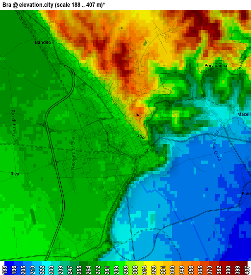
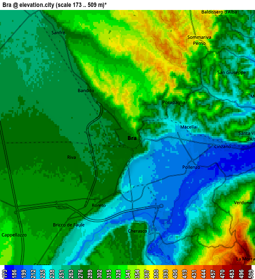
Below is the Elevation map of Bra, which displays elevation range with different colors. Scale of the first map is from 188 to 407 m (617 to 1335 ft) with average elevation of 274 meters (=899 ft) [note 1]
These maps also provides idea of topography and contour of this city, they are displayed at different zoom levels. More info about maps, scale and edge coordinates you can find below images.
| \ | Map #1 | Map #2 | Topo.Map |
| Scale [m] | 188..407 m | 173..509 m | × |
| Scale [ft] | 617..1335 ft | 568..1670 ft | × |
| Average | 274 m = 899 ft | 285.3 m = 936 ft | × |
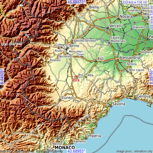
| Width | 6.95 km = 4.3 mi | 13.89 km = 8.6 mi | 222.3 km = 138.1 mi |
| Height | 6.95 km = 4.3 mi | 13.89 km = 8.6 mi | 222.3 km = 138.1 mi |
| ↑Max Latitude | 44.728989° | 44.760201° | 45.68873° |
| Latitude at center | 44.69776° | 44.69776° | 44.69776° |
| ↓Min Latitude | 44.666514° | 44.635251° | 43.68953° |
| ← Min Longitude | 7.807335° | 7.763389° | 6.44503° |
| Longitude center | 7.85128° | 7.85128° | 7.85128° |
| →Max Longitude | 7.895225° | 7.939171° | 9.25753° |
Nearby cities:
Cities around Bra sort by population:
• Cherasco elevation 289 m
6.1 km,  174°
174°
• Sommariva Perno 372 m
6.6 km,  36°
36°
• Sanfrè 279 m
7.1 km,  327°
327°
• Santa Vittoria d'Alba 243 m
6.8 km,  89°
89°
• Bandito 283 m
3.5 km,  322°
322°
• Roreto 288 m
3.4 km,  203°
203°
• Cinzano 195 m
5.5 km,  95°
95°
• Villa 372 m
6.6 km, 35°
• Villa-Borgo 264 m
6.6 km, 89°
• Pocapaglia 279 m
3.2 km,  52°
52°
• Verduno 355 m
7.2 km,  119°
119°
• Villa 358 m
7.5 km,  71°
71°
Multilingual:
 En español:
Bra elevación 283 m.
 En France:
Bra élévation 283 m.


Sources and notes:
- [note 1] Map square and city borders are not equal. Map elevation data is calculated only from area inside that square.
- [src 1] Elevation data from geonames database provided with same terms of usage.
- [src 2] The elevation map of Bra is generated using elevation data from NASA's 3 arcsec (90m) resolution SRTM data.
- [src 3] Base (background) map © OpenStreetMap contributors tiles are generated by Geofabrik and OpenTopoMap.
Copyright & License:
This Bra Elevation Map is licensed under CC BY-SA. You may reuse any part from this page, if you give a proper credit by linking to this URL:
 More info on terms of use page.