Ceva elevation
Ceva (Piedmont, Provincia di Cuneo), Italy elevation is 381 meters and Ceva elevation in feet is 1250 ft above sea level [src 1]. Ceva is a seat of a third-order administrative division (feature code) with elevation that is 59 meters (194 ft) bigger than average city elevation in Italy.
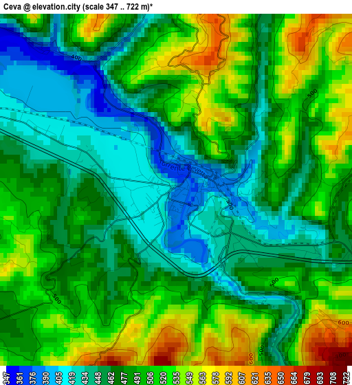
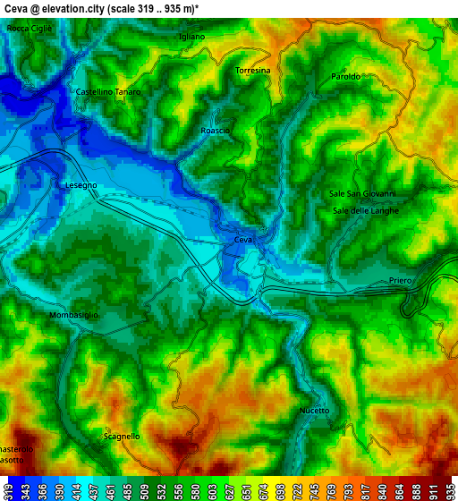
Below is the Elevation map of Ceva, which displays elevation range with different colors. Scale of the first map is from 347 to 722 m (1138 to 2369 ft) with average elevation of 485.8 meters (=1594 ft) [note 1]
These maps also provides idea of topography and contour of this city, they are displayed at different zoom levels. More info about maps, scale and edge coordinates you can find below images.
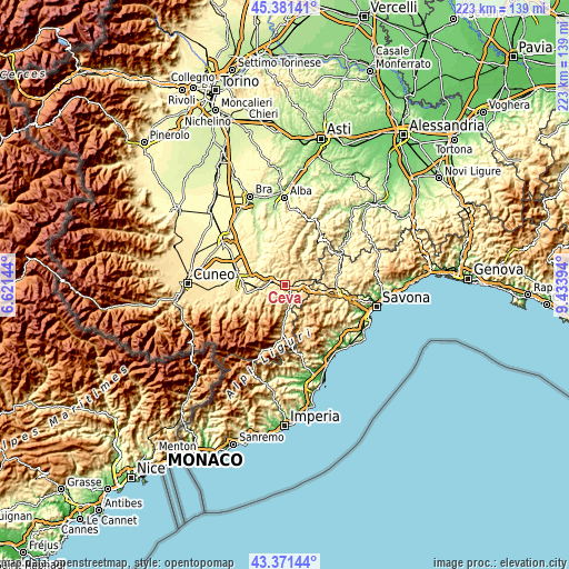
| \ | Map #1 | Map #2 | Topo.Map |
| Scale [m] | 347..722 m | 319..935 m | × |
| Scale [ft] | 1138..2369 ft | 1047..3068 ft | × |
| Average | 485.8 m = 1594 ft | 568.4 m = 1865 ft | × |
| Width | 6.98 km = 4.3 mi | 13.97 km = 8.7 mi | 223.5 km = 138.9 mi |
| Height | 6.98 km = 4.3 mi | 13.97 km = 8.7 mi | 223.5 km = 138.9 mi |
| ↑Max Latitude | 44.416447° | 44.447828° | 45.38141° |
| Latitude at center | 44.38505° | 44.38505° | 44.38505° |
| ↓Min Latitude | 44.353636° | 44.322205° | 43.37144° |
| ← Min Longitude | 7.983745° | 7.939799° | 6.62144° |
| Longitude center | 8.02769° | 8.02769° | 8.02769° |
| →Max Longitude | 8.071635° | 8.115581° | 9.43394° |
Nearby cities:
Cities around Ceva sort by population:
• Lesegno elevation 417 m
5 km,  291°
291°
• Mombasiglio 527 m
5.2 km,  246°
246°
• Priero 473 m
5.3 km,  100°
100°
• Sale delle Langhe 483 m
4.3 km,  74°
74°
• Nucetto 457 m
5.7 km,  153°
153°
• Scagnello 743 m
6.6 km,  209°
209°
• Paroldo 633 m
6.3 km,  34°
34°
• Torresina 708 m
5.5 km,  7°
7°
• Sale San Giovanni 586 m
4.3 km, 68°
• Castellino Tanaro 599 m
6 km,  322°
322°
• Igliano 545 m
6.5 km,  349°
349°
• Roascio 460 m
3.6 km, 353°
Multilingual:
 En español:
Ceva elevación 381 m.
 En France:
Ceva élévation 381 m.


Sources and notes:
- [note 1] Map square and city borders are not equal. Map elevation data is calculated only from area inside that square.
- [src 1] Elevation data from geonames database provided with same terms of usage.
- [src 2] The elevation map of Ceva is generated using elevation data from NASA's 3 arcsec (90m) resolution SRTM data.
- [src 3] Base (background) map © OpenStreetMap contributors tiles are generated by Geofabrik and OpenTopoMap.
Copyright & License:
This Ceva Elevation Map is licensed under CC BY-SA. You may reuse any part from this page, if you give a proper credit by linking to this URL:
 More info on terms of use page.