Sant'Andrea-Pizzone-Ciamprisco elevation
Sant'Andrea-Pizzone-Ciamprisco (Campania, Provincia di Caserta), Italy elevation is 16 meters and Sant'Andrea-Pizzone-Ciamprisco elevation in feet is 52 ft above sea level [src 1]. Sant'Andrea-Pizzone-Ciamprisco is a populated place (feature code) with elevation that is 306 meters (1004 ft) smaller than average city elevation in Italy.
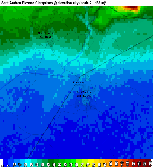
Below is the Elevation map of Sant'Andrea-Pizzone-Ciamprisco, which displays elevation range with different colors. Scale of the first map is from 2 to 136 m (7 to 446 ft) with average elevation of 22 meters (=72 ft) [note 1]
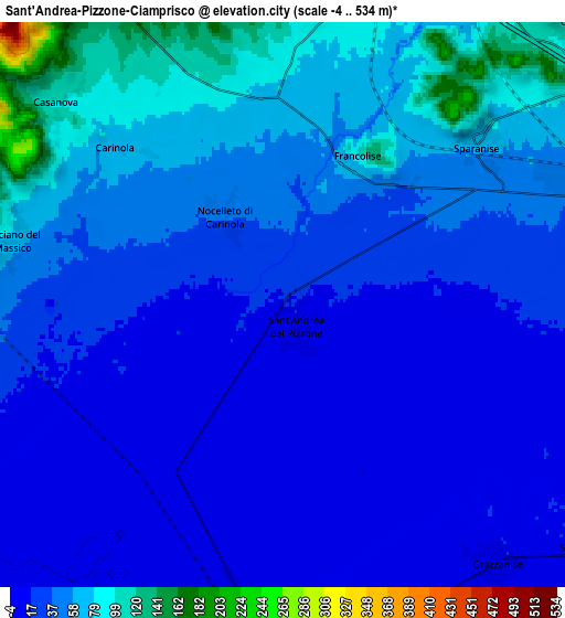
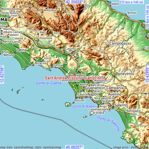
These maps also provides idea of topography and contour of this city, they are displayed at different zoom levels. More info about maps, scale and edge coordinates you can find below images.
| \ | Map #1 | Map #2 | Topo.Map |
| Scale [m] | 2..136 m | -4..534 m | × |
| Scale [ft] | 7..446 ft | -13..1752 ft | × |
| Average | 22 m = 72 ft | 40.2 m = 132 ft | × |
| Width | 7.36 km = 4.6 mi | 14.72 km = 9.1 mi | 235.5 km = 146.3 mi |
| Height | 7.36 km = 4.6 mi | 14.72 km = 9.1 mi | 235.5 km = 146.3 mi |
| ↑Max Latitude | 41.183082° | 41.216147° | 42.20033° |
| Latitude at center | 41.15° | 41.15° | 41.15° |
| ↓Min Latitude | 41.116901° | 41.083786° | 40.08257° |
| ← Min Longitude | 13.989385° | 13.945439° | 12.62708° |
| Longitude center | 14.03333° | 14.03333° | 14.03333° |
| →Max Longitude | 14.077275° | 14.121221° | 15.43958° |
Nearby cities:
Cities around Sant'Andrea-Pizzone-Ciamprisco sort by population:
• Sparanise elevation 68 m
6.7 km,  51°
51°
• Grazzanise 14 m
8.7 km,  140°
140°
• Cancello-Arnone 10 m
8.5 km,  184°
184°
• Falciano del Massico 65 m
7.3 km,  281°
281°
• Santa Maria la Fossa 19 m
10.3 km,  129°
129°
• Nocelleto 45 m
2.7 km,  327°
327°
• Casanova 102 m
7.5 km,  308°
308°
• Casale 178 m
8.2 km,  341°
341°
• Carinola 72 m
6 km, 314°
• Brezza 16 m
7.9 km,  123°
123°
• Francolise 95 m
4.4 km,  26°
26°
• Cancello ed Arnone 10 m
8.6 km, 183°
Multilingual:
 En español:
Sant'Andrea-Pizzone-Ciamprisco elevación 16 m.
 En France:
Sant'Andrea-Pizzone-Ciamprisco élévation 16 m.
 Auf Deutsch:
Sant'Andrea-Pizzone-Ciamprisco höhe über dem Meeresspiegel ist 16 m.
 На русском:
Sant'Andrea-Pizzone-Ciamprisco высота над уровнем моря 16 м
Sources and notes:
- [note 1] Map square and city borders are not equal. Map elevation data is calculated only from area inside that square.
- [src 1] Elevation data from geonames database provided with same terms of usage.
- [src 2] The elevation map of Sant'Andrea-Pizzone-Ciamprisco is generated using elevation data from NASA's 3 arcsec (90m) resolution SRTM data.
- [src 3] Base (background) map © OpenStreetMap contributors tiles are generated by Geofabrik and OpenTopoMap.
Copyright & License:
This Sant'Andrea-Pizzone-Ciamprisco Elevation Map is licensed under CC BY-SA. You may reuse any part from this page, if you give a proper credit by linking to this URL:
 More info on terms of use page.