Cornaiano elevation
Cornaiano (Trentino-Alto Adige, Bolzano), Italy elevation is 439 meters and Cornaiano elevation in feet is 1440 ft above sea level [src 1]. Cornaiano is a populated place (feature code) with elevation that is 117 meters (384 ft) bigger than average city elevation in Italy.
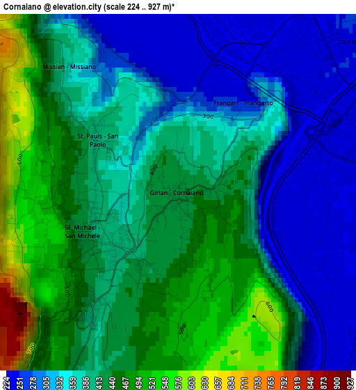
Below is the Elevation map of Cornaiano, which displays elevation range with different colors. Scale of the first map is from 224 to 927 m (735 to 3041 ft) with average elevation of 392.7 meters (=1288 ft) [note 1]
These maps also provides idea of topography and contour of this city, they are displayed at different zoom levels. More info about maps, scale and edge coordinates you can find below images.
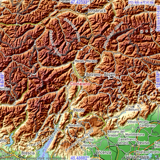
| \ | Map #1 | Topo.Map |
| Scale [m] | 224..927 m | × |
| Scale [ft] | 735..3041 ft | × |
| Average | 392.7 m = 1288 ft | × |
| Width | 6.73 km = 4.2 mi | 215.4 km = 133.8 mi |
| Height | 6.73 km = 4.2 mi | 215.4 km = 133.8 mi |
| ↑Max Latitude | 46.493552° | 47.42333° |
| Latitude at center | 46.46329° | 46.46329° |
| ↓Min Latitude | 46.433011° | 45.48602° |
| ← Min Longitude | 11.237205° | 9.8749° |
| Longitude center | 11.28115° | 11.28115° |
| →Max Longitude | 11.325095° | 12.6874° |
Nearby cities:
Cities around Cornaiano sort by population:
• Bolzano elevation 257 m
5.4 km,  55°
55°
• Laives 250 m
6 km,  132°
132°
• Caldaro sulla Strada del Vino 429 m
6.2 km,  205°
205°
• San Michele 407 m
1.8 km,  237°
237°
• San Giacomo 231 m
4.1 km,  101°
101°
• Bronzolo 245 m
7.3 km,  155°
155°
• Terlano 252 m
8.1 km,  341°
341°
• Pineta 255 m
5.7 km,  117°
117°
• San Paolo 400 m
1.9 km,  301°
301°
• San Genesio Atesino 1079 m
8.8 km,  25°
25°
• Andriano 291 m
7.1 km,  327°
327°
• Vadena 225 m
5.8 km, 161°
Multilingual:
 En español:
Cornaiano elevación 439 m.
 En France:
Cornaiano élévation 439 m.


Sources and notes:
- [note 1] Map square and city borders are not equal. Map elevation data is calculated only from area inside that square.
- [src 1] Elevation data from geonames database provided with same terms of usage.
- [src 2] The elevation map of Cornaiano is generated using elevation data from NASA's 3 arcsec (90m) resolution SRTM data.
- [src 3] Base (background) map © OpenStreetMap contributors tiles are generated by Geofabrik and OpenTopoMap.
Copyright & License:
This Cornaiano Elevation Map is licensed under CC BY-SA. You may reuse any part from this page, if you give a proper credit by linking to this URL:
 More info on terms of use page.