Episcopia elevation
Episcopia (Basilicate, Provincia di Potenza), Italy elevation is 528 meters and Episcopia elevation in feet is 1732 ft above sea level [src 1]. Episcopia is a seat of a third-order administrative division (feature code) with elevation that is 206 meters (676 ft) bigger than average city elevation in Italy.
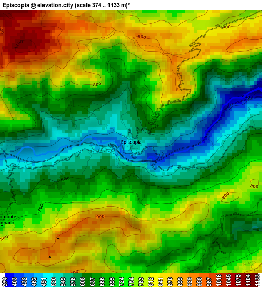
Below is the Elevation map of Episcopia, which displays elevation range with different colors. Scale of the first map is from 374 to 1133 m (1227 to 3717 ft) with average elevation of 720.4 meters (=2364 ft) [note 1]
These maps also provides idea of topography and contour of this city, they are displayed at different zoom levels. More info about maps, scale and edge coordinates you can find below images.
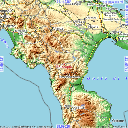
| \ | Map #1 | Topo.Map |
| Scale [m] | 374..1133 m | × |
| Scale [ft] | 1227..3717 ft | × |
| Average | 720.4 m = 2364 ft | × |
| Width | 7.48 km = 4.6 mi | 239.3 km = 148.7 mi |
| Height | 7.48 km = 4.6 mi | 239.3 km = 148.7 mi |
| ↑Max Latitude | 40.108429° | 41.14236° |
| Latitude at center | 40.07481° | 40.07481° |
| ↓Min Latitude | 40.041175° | 38.99026° |
| ← Min Longitude | 16.054235° | 14.69193° |
| Longitude center | 16.09818° | 16.09818° |
| →Max Longitude | 16.142125° | 17.50443° |
Nearby cities:
Cities around Episcopia sort by population:
• Francavilla in Sinni elevation 424 m
9 km,  85°
85°
• Latronico 858 m
7.7 km,  281°
281°
• Castelluccio Inferiore 460 m
12.8 km,  230°
230°
• Castelsaraceno 936 m
13.2 km,  317°
317°
• Chiaromonte 736 m
11.3 km,  61°
61°
• San Severino Lucano 897 m
7 km,  150°
150°
• Carbone 737 m
7.5 km,  353°
353°
• Castelluccio Superiore 688 m
12.9 km,  236°
236°
• Teana 781 m
7.3 km,  39°
39°
• Fardella 750 m
7.5 km,  54°
54°
• Viggianello 542 m
11.5 km,  185°
185°
• Calvera 616 m
9.1 km,  25°
25°
Multilingual:
 En español:
Episcopia elevación 528 m.
 En France:
Episcopia élévation 528 m.
 Auf Deutsch:
Episcopia höhe über dem Meeresspiegel ist 528 m.

Sources and notes:
- [note 1] Map square and city borders are not equal. Map elevation data is calculated only from area inside that square.
- [src 1] Elevation data from geonames database provided with same terms of usage.
- [src 2] The elevation map of Episcopia is generated using elevation data from NASA's 3 arcsec (90m) resolution SRTM data.
- [src 3] Base (background) map © OpenStreetMap contributors tiles are generated by Geofabrik and OpenTopoMap.
Copyright & License:
This Episcopia Elevation Map is licensed under CC BY-SA. You may reuse any part from this page, if you give a proper credit by linking to this URL:
 More info on terms of use page.