Foggia elevation
Foggia (Apulia, Provincia di Foggia), Italy elevation is 72 meters and Foggia elevation in feet is 236 ft above sea level [src 1]. Foggia is a seat of a second-order administrative division (feature code) with elevation that is 250 meters (820 ft) smaller than average city elevation in Italy.
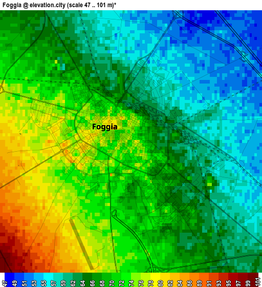
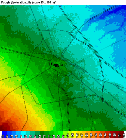
Below is the Elevation map of Foggia, which displays elevation range with different colors. Scale of the first map is from 47 to 101 m (154 to 331 ft) with average elevation of 67.2 meters (=220 ft) [note 1]
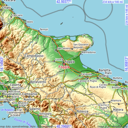
These maps also provides idea of topography and contour of this city, they are displayed at different zoom levels. More info about maps, scale and edge coordinates you can find below images.
| \ | Map #1 | Map #2 | Topo.Map |
| Scale [m] | 47..101 m | 25..166 m | × |
| Scale [ft] | 154..331 ft | 82..545 ft | × |
| Average | 67.2 m = 220 ft | 70.7 m = 232 ft | × |
| Width | 7.32 km = 4.5 mi | 14.65 km = 9.1 mi | 234.4 km = 145.6 mi |
| Height | 7.32 km = 4.5 mi | 14.65 km = 9.1 mi | 234.4 km = 145.6 mi |
| ↑Max Latitude | 41.491376° | 41.524285° | 42.50377° |
| Latitude at center | 41.45845° | 41.45845° | 41.45845° |
| ↓Min Latitude | 41.425507° | 41.392548° | 40.39601° |
| ← Min Longitude | 15.507935° | 15.463989° | 14.14563° |
| Longitude center | 15.55188° | 15.55188° | 15.55188° |
| →Max Longitude | 15.595825° | 15.639771° | 16.95813° |
Nearby cities:
Cities around Foggia sort by population:
• San Severo elevation 92 m
29 km,  330°
330°
• Lucera 217 m
18.5 km,  286°
286°
• Orta Nova 69 m
19.5 km,  137°
137°
• San Marco in Lamis 559 m
29.1 km,  14°
14°
• Troia 384 m
22.2 km,  241°
241°
• Carapelle 61 m
15.9 km,  131°
131°
• Ascoli Satriano 418 m
28.4 km,  177°
177°
• Stornara 108 m
26.4 km, 136°
• Stornarella 153 m
27 km,  146°
146°
• Ordona 121 m
17.2 km,  158°
158°
• Rignano Garganico 579 m
24.7 km, 7°
• Castelluccio dei Sauri 280 m
18.3 km,  200°
200°
Multilingual:
 En español:
Foggia elevación 72 m.
 En France:
Foggia élévation 72 m.


Sources and notes:
- [note 1] Map square and city borders are not equal. Map elevation data is calculated only from area inside that square.
- [src 1] Elevation data from geonames database provided with same terms of usage.
- [src 2] The elevation map of Foggia is generated using elevation data from NASA's 3 arcsec (90m) resolution SRTM data.
- [src 3] Base (background) map © OpenStreetMap contributors tiles are generated by Geofabrik and OpenTopoMap.
Copyright & License:
This Foggia Elevation Map is licensed under CC BY-SA. You may reuse any part from this page, if you give a proper credit by linking to this URL:
 More info on terms of use page.