Gamalero elevation
Gamalero (Piedmont, Provincia di Alessandria), Italy elevation is 144 meters and Gamalero elevation in feet is 472 ft above sea level [src 1]. Gamalero is a seat of a third-order administrative division (feature code) with elevation that is 178 meters (584 ft) smaller than average city elevation in Italy.
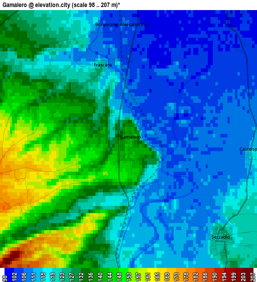
Below is the Elevation map of Gamalero, which displays elevation range with different colors. Scale of the first map is from 98 to 207 m (322 to 679 ft) with average elevation of 124.1 meters (=407 ft) [note 1]
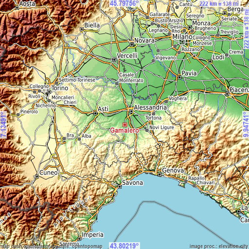
These maps also provides idea of topography and contour of this city, they are displayed at different zoom levels. More info about maps, scale and edge coordinates you can find below images.
| \ | Map #1 | Topo.Map |
| Scale [m] | 98..207 m | × |
| Scale [ft] | 322..679 ft | × |
| Average | 124.1 m = 407 ft | × |
| Width | 6.93 km = 4.3 mi | 221.9 km = 137.9 mi |
| Height | 6.93 km = 4.3 mi | 221.9 km = 137.9 mi |
| ↑Max Latitude | 44.839669° | 45.79756° |
| Latitude at center | 44.8085° | 44.8085° |
| ↓Min Latitude | 44.777314° | 43.80219° |
| ← Min Longitude | 8.497215° | 7.13491° |
| Longitude center | 8.54116° | 8.54116° |
| →Max Longitude | 8.585105° | 9.94741° |
Nearby cities:
Cities around Gamalero sort by population:
• Castellazzo Bormida elevation 107 m
4.9 km,  37°
37°
• Cassine 135 m
6.4 km,  188°
188°
• Sezzadio 123 m
3.6 km,  136°
136°
• Oviglio 109 m
7.2 km,  324°
324°
• Casal Cermelli 106 m
7.2 km,  66°
66°
• Bergamasco 126 m
7.1 km,  287°
287°
• Borgoratto Alessandrino 107 m
3.1 km,  356°
356°
• Castelnuovo Bormida 125 m
7.4 km,  174°
174°
• Frascaro 125 m
2.1 km,  337°
337°
• Castelspina 115 m
3.3 km,  94°
94°
• Carentino 156 m
6 km, 292°
• Maranzana 266 m
7.3 km,  222°
222°
Multilingual:
 En español:
Gamalero elevación 144 m.
 En France:
Gamalero élévation 144 m.
 Auf Deutsch:
Gamalero höhe über dem Meeresspiegel ist 144 m.

Sources and notes:
- [note 1] Map square and city borders are not equal. Map elevation data is calculated only from area inside that square.
- [src 1] Elevation data from geonames database provided with same terms of usage.
- [src 2] The elevation map of Gamalero is generated using elevation data from NASA's 3 arcsec (90m) resolution SRTM data.
- [src 3] Base (background) map © OpenStreetMap contributors tiles are generated by Geofabrik and OpenTopoMap.
Copyright & License:
This Gamalero Elevation Map is licensed under CC BY-SA. You may reuse any part from this page, if you give a proper credit by linking to this URL:
 More info on terms of use page.