Gandino elevation
Gandino (Lombardy, Provincia di Bergamo), Italy elevation is 530 meters and Gandino elevation in feet is 1739 ft above sea level [src 1]. Gandino is a seat of a third-order administrative division (feature code) with elevation that is 208 meters (682 ft) bigger than average city elevation in Italy.
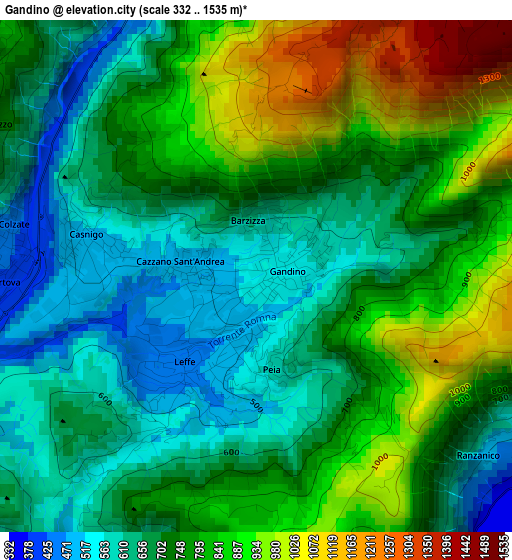
Below is the Elevation map of Gandino, which displays elevation range with different colors. Scale of the first map is from 332 to 1535 m (1089 to 5036 ft) with average elevation of 745.7 meters (=2447 ft) [note 1]
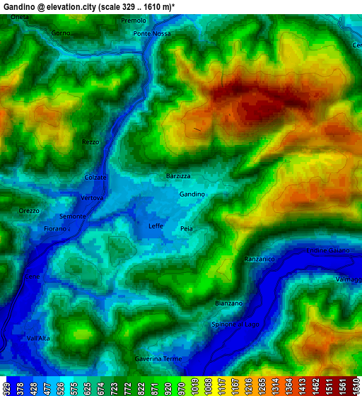
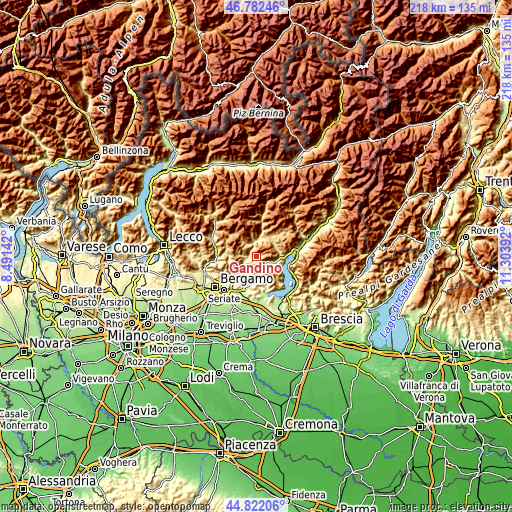
These maps also provides idea of topography and contour of this city, they are displayed at different zoom levels. More info about maps, scale and edge coordinates you can find below images.
| \ | Map #1 | Map #2 | Topo.Map |
| Scale [m] | 332..1535 m | 329..1610 m | × |
| Scale [ft] | 1089..5036 ft | 1079..5282 ft | × |
| Average | 745.7 m = 2447 ft | 777.8 m = 2552 ft | × |
| Width | 6.81 km = 4.2 mi | 13.62 km = 8.5 mi | 218 km = 135.5 mi |
| Height | 6.81 km = 4.2 mi | 13.62 km = 8.5 mi | 218 km = 135.5 mi |
| ↑Max Latitude | 45.841503° | 45.872109° | 46.78246° |
| Latitude at center | 45.81088° | 45.81088° | 45.81088° |
| ↓Min Latitude | 45.78024° | 45.749584° | 44.82206° |
| ← Min Longitude | 9.853725° | 9.809779° | 8.49142° |
| Longitude center | 9.89767° | 9.89767° | 9.89767° |
| →Max Longitude | 9.941615° | 9.985561° | 11.30392° |
Nearby cities:
Cities around Gandino sort by population:
• Vertova elevation 412 m
3.7 km,  268°
268°
• Leffe 454 m
1.8 km,  215°
215°
• Gazzaniga 372 m
5.6 km,  249°
249°
• Fiorano al Serio 392 m
4.4 km, 254°
• Casnigo 506 m
2.3 km,  276°
276°
• Peia 576 m
1.3 km,  174°
174°
• Cazzano Sant'Andrea 486 m
1 km, 271°
• Colzate 437 m
3.3 km, 282°
• Spinone al Lago 353 m
5.5 km,  160°
160°
• Monasterolo del Castello 352 m
5.9 km,  153°
153°
• Bianzano 602 m
4.5 km, 159°
• Ranzanico 495 m
3.8 km,  130°
130°
Multilingual:
 En español:
Gandino elevación 530 m.
 En France:
Gandino élévation 530 m.


Sources and notes:
- [note 1] Map square and city borders are not equal. Map elevation data is calculated only from area inside that square.
- [src 1] Elevation data from geonames database provided with same terms of usage.
- [src 2] The elevation map of Gandino is generated using elevation data from NASA's 3 arcsec (90m) resolution SRTM data.
- [src 3] Base (background) map © OpenStreetMap contributors tiles are generated by Geofabrik and OpenTopoMap.
Copyright & License:
This Gandino Elevation Map is licensed under CC BY-SA. You may reuse any part from this page, if you give a proper credit by linking to this URL:
 More info on terms of use page.