Gattinara elevation
Gattinara (Piedmont, Provincia di Vercelli), Italy elevation is 264 meters and Gattinara elevation in feet is 866 ft above sea level [src 1]. Gattinara is a seat of a third-order administrative division (feature code) with elevation that is 58 meters (190 ft) smaller than average city elevation in Italy.
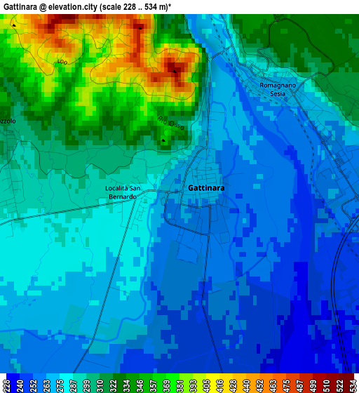
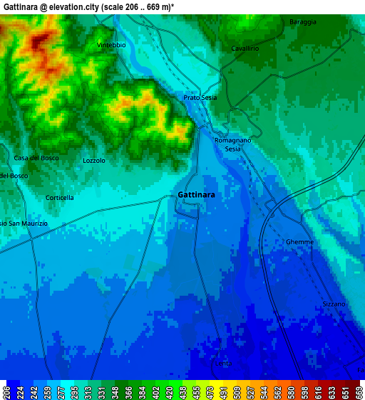
Below is the Elevation map of Gattinara, which displays elevation range with different colors. Scale of the first map is from 228 to 534 m (748 to 1752 ft) with average elevation of 291.9 meters (=958 ft) [note 1]
These maps also provides idea of topography and contour of this city, they are displayed at different zoom levels. More info about maps, scale and edge coordinates you can find below images.
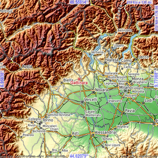
| \ | Map #1 | Map #2 | Topo.Map |
| Scale [m] | 228..534 m | 206..669 m | × |
| Scale [ft] | 748..1752 ft | 676..2195 ft | × |
| Average | 291.9 m = 958 ft | 297 m = 974 ft | × |
| Width | 6.84 km = 4.3 mi | 13.67 km = 8.5 mi | 218.7 km = 135.9 mi |
| Height | 6.84 km = 4.3 mi | 13.67 km = 8.5 mi | 218.7 km = 135.9 mi |
| ↑Max Latitude | 45.643821° | 45.674536° | 46.58814° |
| Latitude at center | 45.61309° | 45.61309° | 45.61309° |
| ↓Min Latitude | 45.582342° | 45.551577° | 44.62079° |
| ← Min Longitude | 8.320685° | 8.276739° | 6.95838° |
| Longitude center | 8.36463° | 8.36463° | 8.36463° |
| →Max Longitude | 8.408575° | 8.452521° | 9.77088° |
Nearby cities:
Cities around Gattinara sort by population:
• Grignasco elevation 318 m
7.6 km,  348°
348°
• Romagnano Sesia 273 m
2.8 km,  38°
38°
• Ghemme 245 m
4.6 km,  110°
110°
• Roasio 287 m
6.3 km,  261°
261°
• Prato Sesia 285 m
4.2 km,  8°
8°
• Sizzano 229 m
6.9 km,  126°
126°
• Cavallirio 363 m
6 km,  24°
24°
• San Maurizio 307 m
6.1 km, 259°
• Lenta 224 m
6.4 km,  166°
166°
• Boca 392 m
8.1 km,  25°
25°
• Lozzolo 300 m
3.3 km,  281°
281°
• Villa del Bosco 334 m
6.8 km,  273°
273°
Multilingual:
 En español:
Gattinara elevación 264 m.
 En France:
Gattinara élévation 264 m.
 Auf Deutsch:
Gattinara höhe über dem Meeresspiegel ist 264 m.

Sources and notes:
- [note 1] Map square and city borders are not equal. Map elevation data is calculated only from area inside that square.
- [src 1] Elevation data from geonames database provided with same terms of usage.
- [src 2] The elevation map of Gattinara is generated using elevation data from NASA's 3 arcsec (90m) resolution SRTM data.
- [src 3] Base (background) map © OpenStreetMap contributors tiles are generated by Geofabrik and OpenTopoMap.
Copyright & License:
This Gattinara Elevation Map is licensed under CC BY-SA. You may reuse any part from this page, if you give a proper credit by linking to this URL:
 More info on terms of use page.