Grumolo Pedemonte elevation
Grumolo Pedemonte (Veneto, Provincia di Vicenza), Italy elevation is 154 meters and Grumolo Pedemonte elevation in feet is 505 ft above sea level [src 1]. Grumolo Pedemonte is a populated place (feature code) with elevation that is 168 meters (551 ft) smaller than average city elevation in Italy.
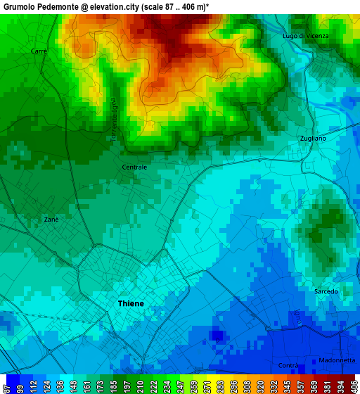
Below is the Elevation map of Grumolo Pedemonte, which displays elevation range with different colors. Scale of the first map is from 87 to 406 m (285 to 1332 ft) with average elevation of 177.3 meters (=582 ft) [note 1]
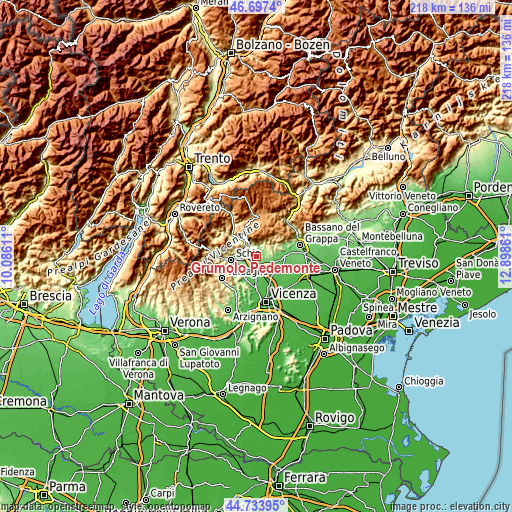
These maps also provides idea of topography and contour of this city, they are displayed at different zoom levels. More info about maps, scale and edge coordinates you can find below images.
| \ | Map #1 | Topo.Map |
| Scale [m] | 87..406 m | × |
| Scale [ft] | 285..1332 ft | × |
| Average | 177.3 m = 582 ft | × |
| Width | 6.82 km = 4.2 mi | 218.3 km = 135.6 mi |
| Height | 6.82 km = 4.2 mi | 218.3 km = 135.6 mi |
| ↑Max Latitude | 45.75497° | 46.6974° |
| Latitude at center | 45.7243° | 45.7243° |
| ↓Min Latitude | 45.693613° | 44.73395° |
| ← Min Longitude | 11.448415° | 10.08611° |
| Longitude center | 11.49236° | 11.49236° |
| →Max Longitude | 11.536305° | 12.89861° |
Nearby cities:
Cities around Grumolo Pedemonte sort by population:
• Thiene elevation 151 m
2 km,  209°
209°
• Marano Vicentino 137 m
5.6 km,  235°
235°
• Zanè 173 m
3.4 km,  265°
265°
• Breganze 108 m
5.7 km,  112°
112°
• Sarcedo 112 m
3.9 km,  131°
131°
• Zugliano 145 m
2.5 km,  76°
76°
• Carrè 224 m
3.8 km,  315°
315°
• Chiuppano 245 m
5.1 km,  328°
328°
• Lugo di Vicenza 165 m
3.7 km,  50°
50°
• Fara Vicentino 212 m
4.6 km,  62°
62°
• Centrale 176 m
1 km,  290°
290°
• Calvene 197 m
4.9 km,  17°
17°
Multilingual:
 En español:
Grumolo Pedemonte elevación 154 m.
 En France:
Grumolo Pedemonte élévation 154 m.
 Auf Deutsch:
Grumolo Pedemonte höhe über dem Meeresspiegel ist 154 m.

Sources and notes:
- [note 1] Map square and city borders are not equal. Map elevation data is calculated only from area inside that square.
- [src 1] Elevation data from geonames database provided with same terms of usage.
- [src 2] The elevation map of Grumolo Pedemonte is generated using elevation data from NASA's 3 arcsec (90m) resolution SRTM data.
- [src 3] Base (background) map © OpenStreetMap contributors tiles are generated by Geofabrik and OpenTopoMap.
Copyright & License:
This Grumolo Pedemonte Elevation Map is licensed under CC BY-SA. You may reuse any part from this page, if you give a proper credit by linking to this URL:
 More info on terms of use page.