Lenola elevation
Lenola (Latium, Provincia di Latina), Italy elevation is 440 meters and Lenola elevation in feet is 1444 ft above sea level [src 1]. Lenola is a seat of a third-order administrative division (feature code) with elevation that is 118 meters (387 ft) bigger than average city elevation in Italy.
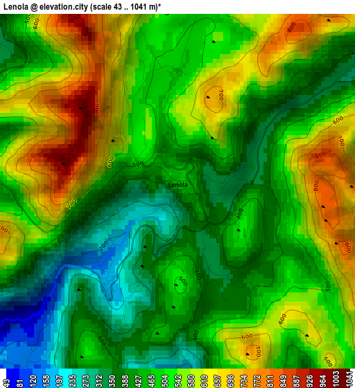
Below is the Elevation map of Lenola, which displays elevation range with different colors. Scale of the first map is from 43 to 1041 m (141 to 3415 ft) with average elevation of 497.6 meters (=1633 ft) [note 1]
These maps also provides idea of topography and contour of this city, they are displayed at different zoom levels. More info about maps, scale and edge coordinates you can find below images.
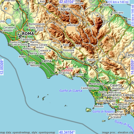
| \ | Map #1 | Topo.Map |
| Scale [m] | 43..1041 m | × |
| Scale [ft] | 141..3415 ft | × |
| Average | 497.6 m = 1633 ft | × |
| Width | 7.33 km = 4.6 mi | 234.6 km = 145.8 mi |
| Height | 7.33 km = 4.6 mi | 234.5 km = 145.7 mi |
| ↑Max Latitude | 41.437803° | 42.45104° |
| Latitude at center | 41.40485° | 41.40485° |
| ↓Min Latitude | 41.37188° | 40.34154° |
| ← Min Longitude | 13.415395° | 12.05309° |
| Longitude center | 13.45934° | 13.45934° |
| →Max Longitude | 13.503285° | 14.86559° |
Nearby cities:
Cities around Lenola sort by population:
• Fondi elevation 18 m
5.9 km,  207°
207°
• Itri 174 m
14 km,  155°
155°
• Ceprano 111 m
16.3 km,  16°
16°
• Monte San Biagio 120 m
10.6 km,  237°
237°
• Vallecorsa 372 m
6.2 km,  314°
314°
• Amaseno 101 m
12.5 km,  303°
303°
• San Giovanni Incarico 158 m
13.4 km,  38°
38°
• Pico 168 m
9.7 km,  58°
58°
• Pastena 301 m
7.5 km, 20°
• Castro dei Volsci 360 m
12.3 km,  338°
338°
• Campodimele 615 m
6.2 km,  107°
107°
• Falvaterra 296 m
12.3 km,  25°
25°
Multilingual:
 En español:
Lenola elevación 440 m.
 En France:
Lenola élévation 440 m.


Sources and notes:
- [note 1] Map square and city borders are not equal. Map elevation data is calculated only from area inside that square.
- [src 1] Elevation data from geonames database provided with same terms of usage.
- [src 2] The elevation map of Lenola is generated using elevation data from NASA's 3 arcsec (90m) resolution SRTM data.
- [src 3] Base (background) map © OpenStreetMap contributors tiles are generated by Geofabrik and OpenTopoMap.
Copyright & License:
This Lenola Elevation Map is licensed under CC BY-SA. You may reuse any part from this page, if you give a proper credit by linking to this URL:
 More info on terms of use page.