Lombardore elevation
Lombardore (Piedmont, Torino), Italy elevation is 267 meters and Lombardore elevation in feet is 876 ft above sea level [src 1]. Lombardore is a seat of a third-order administrative division (feature code) with elevation that is 55 meters (180 ft) smaller than average city elevation in Italy.
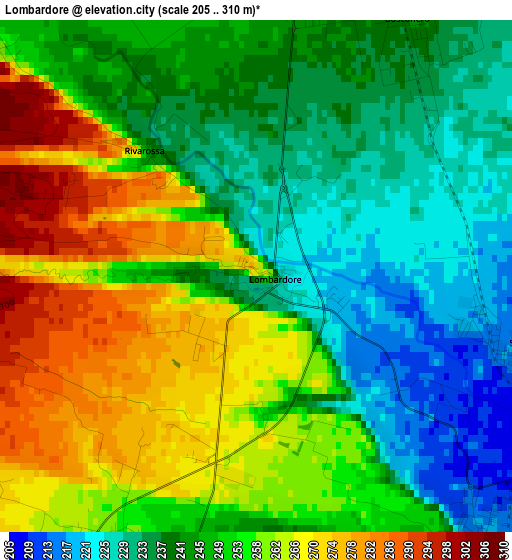
Below is the Elevation map of Lombardore, which displays elevation range with different colors. Scale of the first map is from 205 to 310 m (673 to 1017 ft) with average elevation of 249.6 meters (=819 ft) [note 1]
These maps also provides idea of topography and contour of this city, they are displayed at different zoom levels. More info about maps, scale and edge coordinates you can find below images.
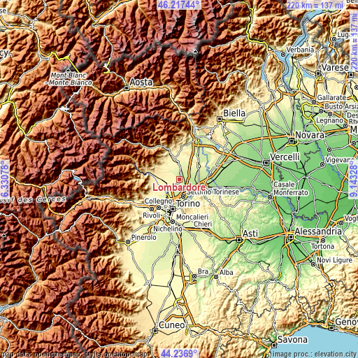
| \ | Map #1 | Topo.Map |
| Scale [m] | 205..310 m | × |
| Scale [ft] | 673..1017 ft | × |
| Average | 249.6 m = 819 ft | × |
| Width | 6.88 km = 4.3 mi | 220.2 km = 136.8 mi |
| Height | 6.88 km = 4.3 mi | 220.2 km = 136.8 mi |
| ↑Max Latitude | 45.266737° | 46.21744° |
| Latitude at center | 45.2358° | 45.2358° |
| ↓Min Latitude | 45.204846° | 44.2369° |
| ← Min Longitude | 7.693085° | 6.33078° |
| Longitude center | 7.73703° | 7.73703° |
| →Max Longitude | 7.780975° | 9.14328° |
Nearby cities:
Cities around Lombardore sort by population:
• Volpiano elevation 221 m
5 km,  143°
143°
• Leini 250 m
6.2 km,  196°
196°
• San Maurizio 317 m
8.6 km,  255°
255°
• Montanaro 214 m
9.2 km,  92°
92°
• San Benigno Canavese 212 m
3.9 km,  106°
106°
• San Francesco al Campo 327 m
6.5 km, 261°
• Bosconero 242 m
4.1 km,  33°
33°
• Foglizzo 234 m
7.8 km,  57°
57°
• Feletto 276 m
7.5 km,  4°
4°
• Rivarossa 245 m
2.1 km,  318°
318°
• Front 277 m
7.5 km,  310°
310°
• Lusigliè 270 m
9.4 km,  13°
13°
Multilingual:
 En español:
Lombardore elevación 267 m.
 En France:
Lombardore élévation 267 m.
 Auf Deutsch:
Lombardore höhe über dem Meeresspiegel ist 267 m.

Sources and notes:
- [note 1] Map square and city borders are not equal. Map elevation data is calculated only from area inside that square.
- [src 1] Elevation data from geonames database provided with same terms of usage.
- [src 2] The elevation map of Lombardore is generated using elevation data from NASA's 3 arcsec (90m) resolution SRTM data.
- [src 3] Base (background) map © OpenStreetMap contributors tiles are generated by Geofabrik and OpenTopoMap.
Copyright & License:
This Lombardore Elevation Map is licensed under CC BY-SA. You may reuse any part from this page, if you give a proper credit by linking to this URL:
 More info on terms of use page.