San Francesco al Campo elevation
San Francesco al Campo (Piedmont, Torino), Italy elevation is 327 meters and San Francesco al Campo elevation in feet is 1073 ft above sea level [src 1]. San Francesco al Campo is a seat of a third-order administrative division (feature code) with elevation that is 5 meters (16 ft) bigger than average city elevation in Italy.
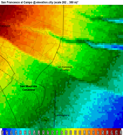
Below is the Elevation map of San Francesco al Campo, which displays elevation range with different colors. Scale of the first map is from 262 to 380 m (860 to 1247 ft) with average elevation of 314.9 meters (=1033 ft) [note 1]
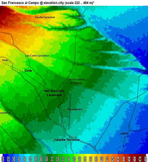
These maps also provides idea of topography and contour of this city, they are displayed at different zoom levels. More info about maps, scale and edge coordinates you can find below images.
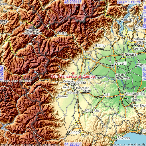
| \ | Map #1 | Map #2 | Topo.Map |
| Scale [m] | 262..380 m | 222..484 m | × |
| Scale [ft] | 860..1247 ft | 728..1588 ft | × |
| Average | 314.9 m = 1033 ft | 307.1 m = 1008 ft | × |
| Width | 6.88 km = 4.3 mi | 13.77 km = 8.6 mi | 220.2 km = 136.8 mi |
| Height | 6.88 km = 4.3 mi | 13.77 km = 8.6 mi | 220.2 km = 136.8 mi |
| ↑Max Latitude | 45.258262° | 45.289187° | 46.20911° |
| Latitude at center | 45.22732° | 45.22732° | 45.22732° |
| ↓Min Latitude | 45.196361° | 45.165385° | 44.22828° |
| ← Min Longitude | 7.610845° | 7.566899° | 6.24854° |
| Longitude center | 7.65479° | 7.65479° | 7.65479° |
| →Max Longitude | 7.698735° | 7.742681° | 9.06104° |
Nearby cities:
Cities around San Francesco al Campo sort by population:
• Ciriè elevation 350 m
4.3 km,  281°
281°
• Leini 250 m
6.8 km,  136°
136°
• Caselle Torinese 280 m
5.9 km,  189°
189°
• San Maurizio 317 m
2.2 km,  239°
239°
• Nole 377 m
6.8 km, 283°
• San Carlo Canavese 364 m
4.3 km,  296°
296°
• Robassomero 364 m
7.6 km, 244°
• Lombardore 267 m
6.5 km,  81°
81°
• Rivarossa 245 m
5.6 km,  64°
64°
• Vauda Canavese Superiore 398 m
6.4 km,  334°
334°
• Barbania 351 m
7.3 km,  347°
347°
• Front 277 m
5.8 km,  7°
7°
Multilingual:
 En español:
San Francesco al Campo elevación 327 m.
 En France:
San Francesco al Campo élévation 327 m.
 Auf Deutsch:
San Francesco al Campo höhe über dem Meeresspiegel ist 327 m.
 На русском:
San Francesco al Campo высота над уровнем моря 327 м
Sources and notes:
- [note 1] Map square and city borders are not equal. Map elevation data is calculated only from area inside that square.
- [src 1] Elevation data from geonames database provided with same terms of usage.
- [src 2] The elevation map of San Francesco al Campo is generated using elevation data from NASA's 3 arcsec (90m) resolution SRTM data.
- [src 3] Base (background) map © OpenStreetMap contributors tiles are generated by Geofabrik and OpenTopoMap.
Copyright & License:
This San Francesco al Campo Elevation Map is licensed under CC BY-SA. You may reuse any part from this page, if you give a proper credit by linking to this URL:
 More info on terms of use page.