Lugagnano elevation
Lugagnano (Veneto, Provincia di Verona), Italy elevation is 92 meters and Lugagnano elevation in feet is 302 ft above sea level [src 1]. Lugagnano is a populated place (feature code) with elevation that is 230 meters (755 ft) smaller than average city elevation in Italy.
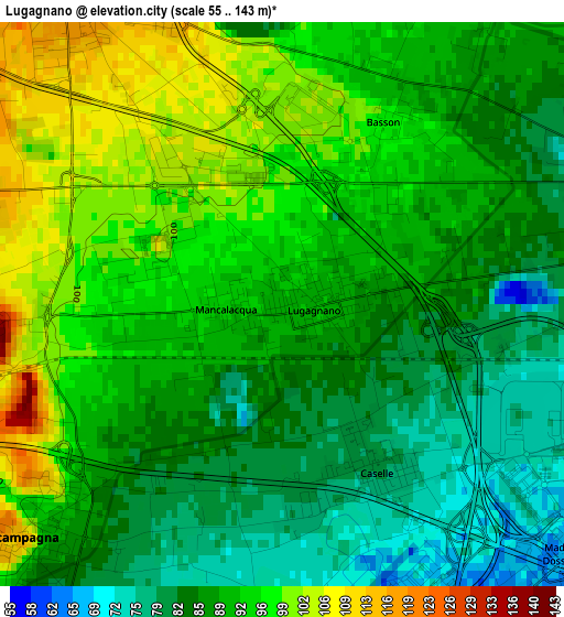
Below is the Elevation map of Lugagnano, which displays elevation range with different colors. Scale of the first map is from 55 to 143 m (180 to 469 ft) with average elevation of 90 meters (=295 ft) [note 1]
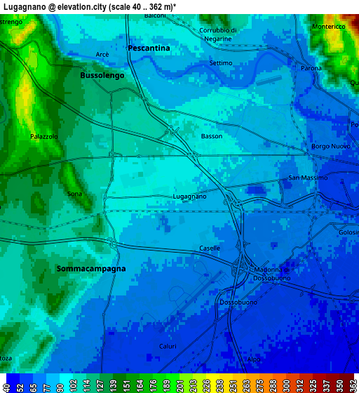
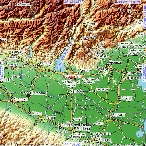
These maps also provides idea of topography and contour of this city, they are displayed at different zoom levels. More info about maps, scale and edge coordinates you can find below images.
| \ | Map #1 | Map #2 | Topo.Map |
| Scale [m] | 55..143 m | 40..362 m | × |
| Scale [ft] | 180..469 ft | 131..1188 ft | × |
| Average | 90 m = 295 ft | 94.2 m = 309 ft | × |
| Width | 6.86 km = 4.3 mi | 13.72 km = 8.5 mi | 219.4 km = 136.3 mi |
| Height | 6.86 km = 4.3 mi | 13.72 km = 8.5 mi | 219.4 km = 136.3 mi |
| ↑Max Latitude | 45.4641° | 45.494913° | 46.41147° |
| Latitude at center | 45.43327° | 45.43327° | 45.43327° |
| ↓Min Latitude | 45.402423° | 45.37156° | 44.43782° |
| ← Min Longitude | 10.840075° | 10.796129° | 9.47777° |
| Longitude center | 10.88402° | 10.88402° | 10.88402° |
| →Max Longitude | 10.927965° | 10.971911° | 12.29027° |
Nearby cities:
Cities around Lugagnano sort by population:
• Bussolengo elevation 120 m
4.6 km,  329°
329°
• Pescantina 92 m
5.9 km,  347°
347°
• Sommacampagna 95 m
4.4 km,  225°
225°
• Dossobuono 63 m
4.9 km,  155°
155°
• Caselle 77 m
2.4 km, 157°
• Sona 125 m
3.4 km,  268°
268°
• Parona 71 m
6.9 km,  42°
42°
• Alpo 54 m
6.9 km, 155°
• Corrubbio 109 m
6.1 km,  14°
14°
• Bassone 99 m
2.1 km,  22°
22°
• Settimo 83 m
5.5 km, 20°
• San Vito al Mantico 91 m
4.3 km, 8°
Multilingual:
 En español:
Lugagnano elevación 92 m.
 En France:
Lugagnano élévation 92 m.
 Auf Deutsch:
Lugagnano di Sona höhe über dem Meeresspiegel ist 92 m.

Sources and notes:
- [note 1] Map square and city borders are not equal. Map elevation data is calculated only from area inside that square.
- [src 1] Elevation data from geonames database provided with same terms of usage.
- [src 2] The elevation map of Lugagnano is generated using elevation data from NASA's 3 arcsec (90m) resolution SRTM data.
- [src 3] Base (background) map © OpenStreetMap contributors tiles are generated by Geofabrik and OpenTopoMap.
Copyright & License:
This Lugagnano Elevation Map is licensed under CC BY-SA. You may reuse any part from this page, if you give a proper credit by linking to this URL:
 More info on terms of use page.