Pescantina elevation
Pescantina (Veneto, Provincia di Verona), Italy elevation is 92 meters and Pescantina elevation in feet is 302 ft above sea level [src 1]. Pescantina is a seat of a third-order administrative division (feature code) with elevation that is 230 meters (755 ft) smaller than average city elevation in Italy.
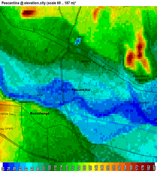
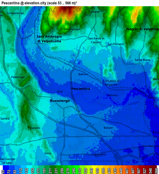
Below is the Elevation map of Pescantina, which displays elevation range with different colors. Scale of the first map is from 69 to 187 m (226 to 614 ft) with average elevation of 107.8 meters (=354 ft) [note 1]
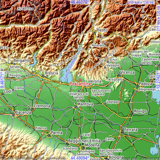
These maps also provides idea of topography and contour of this city, they are displayed at different zoom levels. More info about maps, scale and edge coordinates you can find below images.
| \ | Map #1 | Map #2 | Topo.Map |
| Scale [m] | 69..187 m | 53..566 m | × |
| Scale [ft] | 226..614 ft | 174..1857 ft | × |
| Average | 107.8 m = 354 ft | 136.4 m = 448 ft | × |
| Width | 6.85 km = 4.3 mi | 13.7 km = 8.5 mi | 219.2 km = 136.2 mi |
| Height | 6.85 km = 4.3 mi | 13.7 km = 8.5 mi | 219.2 km = 136.2 mi |
| ↑Max Latitude | 45.516281° | 45.547066° | 46.46276° |
| Latitude at center | 45.48548° | 45.48548° | 45.48548° |
| ↓Min Latitude | 45.454662° | 45.423827° | 44.49094° |
| ← Min Longitude | 10.824015° | 10.780069° | 9.46171° |
| Longitude center | 10.86796° | 10.86796° | 10.86796° |
| →Max Longitude | 10.911905° | 10.955851° | 12.27421° |
Nearby cities:
Cities around Pescantina sort by population:
• Bussolengo elevation 120 m
2.1 km,  211°
211°
• Sant'Ambrogio di Valpollicella 158 m
4.7 km,  327°
327°
• San Pietro in Cariano 157 m
3.8 km,  21°
21°
• Arbizzano-Santa Maria 90 m
5.6 km,  79°
79°
• Pedemonte 112 m
4.4 km,  63°
63°
• San Floriano 139 m
4.8 km,  40°
40°
• Pastrengo 184 m
5.5 km,  282°
282°
• Corrubbio 109 m
2.8 km,  86°
86°
• Bassone 99 m
4.3 km,  151°
151°
• Settimo 83 m
3.3 km,  102°
102°
• San Vito al Mantico 91 m
2.5 km,  128°
128°
• Ospedaletto 122 m
2.9 km,  316°
316°
Multilingual:
 En español:
Pescantina elevación 92 m.
 En France:
Pescantina élévation 92 m.
 Auf Deutsch:
Pescantina höhe über dem Meeresspiegel ist 92 m.

Sources and notes:
- [note 1] Map square and city borders are not equal. Map elevation data is calculated only from area inside that square.
- [src 1] Elevation data from geonames database provided with same terms of usage.
- [src 2] The elevation map of Pescantina is generated using elevation data from NASA's 3 arcsec (90m) resolution SRTM data.
- [src 3] Base (background) map © OpenStreetMap contributors tiles are generated by Geofabrik and OpenTopoMap.
Copyright & License:
This Pescantina Elevation Map is licensed under CC BY-SA. You may reuse any part from this page, if you give a proper credit by linking to this URL:
 More info on terms of use page.