Mezzano elevation
Mezzano (Trentino-Alto Adige, Provincia autonoma di Trento), Italy elevation is 638 meters and Mezzano elevation in feet is 2093 ft above sea level [src 1]. Mezzano is a seat of a third-order administrative division (feature code) with elevation that is 316 meters (1037 ft) bigger than average city elevation in Italy.
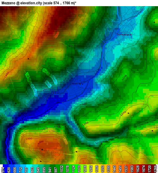
Below is the Elevation map of Mezzano, which displays elevation range with different colors. Scale of the first map is from 574 to 1766 m (1883 to 5794 ft) with average elevation of 1061 meters (=3481 ft) [note 1]
These maps also provides idea of topography and contour of this city, they are displayed at different zoom levels. More info about maps, scale and edge coordinates you can find below images.
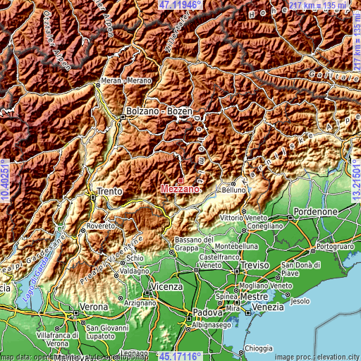
| \ | Map #1 | Topo.Map |
| Scale [m] | 574..1766 m | × |
| Scale [ft] | 1883..5794 ft | × |
| Average | 1061 m = 3481 ft | × |
| Width | 6.77 km = 4.2 mi | 216.6 km = 134.6 mi |
| Height | 6.77 km = 4.2 mi | 216.6 km = 134.6 mi |
| ↑Max Latitude | 46.184364° | 47.11946° |
| Latitude at center | 46.15393° | 46.15393° |
| ↓Min Latitude | 46.12348° | 45.17116° |
| ← Min Longitude | 11.764815° | 10.40251° |
| Longitude center | 11.80876° | 11.80876° |
| →Max Longitude | 11.852705° | 13.21501° |
Nearby cities:
Cities around Mezzano sort by population:
• Transacqua elevation 719 m
2.9 km,  40°
40°
• Lamon 594 m
12.7 km,  200°
200°
• Sovramonte 618 m
10.7 km,  189°
189°
• Tonadico 746 m
3.8 km, 37°
• Imer 649 m
1.6 km,  251°
251°
• Gosaldo 1143 m
13.6 km,  56°
56°
• Siror 761 m
4.1 km,  24°
24°
• Fiera di Primiero 712 m
2.9 km,  31°
31°
• Canal San Bovo 734 m
6.1 km,  272°
272°
• Don 1143 m
13.6 km, 56°
• Servo 618 m
10.8 km, 189°
• Sagron Mis 1062 m
11.3 km,  66°
66°
Multilingual:
 En español:
Mezzano elevación 638 m.
 En France:
Mezzano élévation 638 m.


Sources and notes:
- [note 1] Map square and city borders are not equal. Map elevation data is calculated only from area inside that square.
- [src 1] Elevation data from geonames database provided with same terms of usage.
- [src 2] The elevation map of Mezzano is generated using elevation data from NASA's 3 arcsec (90m) resolution SRTM data.
- [src 3] Base (background) map © OpenStreetMap contributors tiles are generated by Geofabrik and OpenTopoMap.
Copyright & License:
This Mezzano Elevation Map is licensed under CC BY-SA. You may reuse any part from this page, if you give a proper credit by linking to this URL:
 More info on terms of use page.