Montaione elevation
Montaione (Tuscany, Province of Florence), Italy elevation is 335 meters and Montaione elevation in feet is 1099 ft above sea level [src 1]. Montaione is a seat of a third-order administrative division (feature code) with elevation that is 13 meters (43 ft) bigger than average city elevation in Italy.
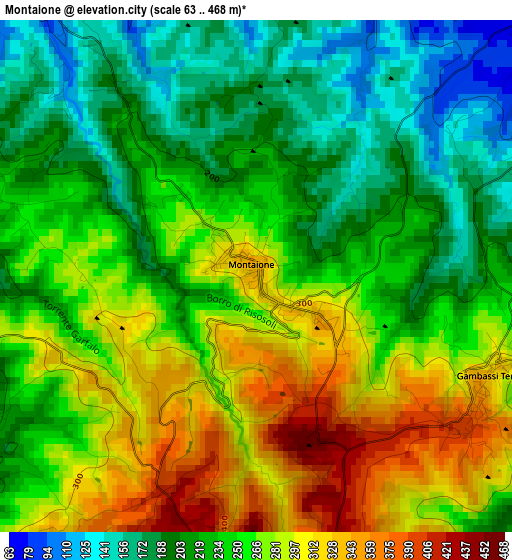
Below is the Elevation map of Montaione, which displays elevation range with different colors. Scale of the first map is from 63 to 468 m (207 to 1535 ft) with average elevation of 248.9 meters (=817 ft) [note 1]
These maps also provides idea of topography and contour of this city, they are displayed at different zoom levels. More info about maps, scale and edge coordinates you can find below images.
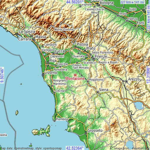
| \ | Map #1 | Topo.Map |
| Scale [m] | 63..468 m | × |
| Scale [ft] | 207..1535 ft | × |
| Average | 248.9 m = 817 ft | × |
| Width | 7.08 km = 4.4 mi | 226.6 km = 140.8 mi |
| Height | 7.08 km = 4.4 mi | 226.6 km = 140.8 mi |
| ↑Max Latitude | 43.583281° | 44.56201° |
| Latitude at center | 43.55144° | 43.55144° |
| ↓Min Latitude | 43.519582° | 42.52364° |
| ← Min Longitude | 10.869765° | 9.50746° |
| Longitude center | 10.91371° | 10.91371° |
| →Max Longitude | 10.957655° | 12.31996° |
Nearby cities:
Cities around Montaione sort by population:
• San Miniato Basso elevation 28 m
16.8 km,  339°
339°
• San Miniato 125 m
15.1 km, 340°
• Certaldo 71 m
10.1 km,  92°
92°
• Castelfiorentino 55 m
7.8 km,  33°
33°
• Volterra 529 m
17.1 km,  194°
194°
• Montespertoli 237 m
16.4 km,  51°
51°
• San Gimignano 264 m
12.7 km,  132°
132°
• Peccioli 90 m
15.8 km,  269°
269°
• Gambassi Terme 359 m
3.5 km,  119°
119°
• Pozzale-Case Nuove 35 m
16.4 km,  12°
12°
• Ponte A Elsa 49 m
15.4 km,  353°
353°
• Palaia 205 m
13 km,  297°
297°
Multilingual:
 En español:
Montaione elevación 335 m.
 En France:
Montaione élévation 335 m.
 Auf Deutsch:
Montaione höhe über dem Meeresspiegel ist 335 m.

Sources and notes:
- [note 1] Map square and city borders are not equal. Map elevation data is calculated only from area inside that square.
- [src 1] Elevation data from geonames database provided with same terms of usage.
- [src 2] The elevation map of Montaione is generated using elevation data from NASA's 3 arcsec (90m) resolution SRTM data.
- [src 3] Base (background) map © OpenStreetMap contributors tiles are generated by Geofabrik and OpenTopoMap.
Copyright & License:
This Montaione Elevation Map is licensed under CC BY-SA. You may reuse any part from this page, if you give a proper credit by linking to this URL:
 More info on terms of use page.