Montelapiano elevation
Montelapiano (Abruzzo, Provincia di Chieti), Italy elevation is 709 meters and Montelapiano elevation in feet is 2326 ft above sea level [src 1]. Montelapiano is a seat of a third-order administrative division (feature code) with elevation that is 387 meters (1270 ft) bigger than average city elevation in Italy.
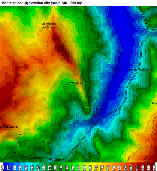
Below is the Elevation map of Montelapiano, which displays elevation range with different colors. Scale of the first map is from 248 to 998 m (814 to 3274 ft) with average elevation of 568.9 meters (=1866 ft) [note 1]
These maps also provides idea of topography and contour of this city, they are displayed at different zoom levels. More info about maps, scale and edge coordinates you can find below images.
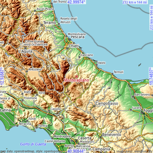
| \ | Map #1 | Topo.Map |
| Scale [m] | 248..998 m | × |
| Scale [ft] | 814..3274 ft | × |
| Average | 568.9 m = 1866 ft | × |
| Width | 7.27 km = 4.5 mi | 232.5 km = 144.5 mi |
| Height | 7.27 km = 4.5 mi | 232.5 km = 144.5 mi |
| ↑Max Latitude | 41.995339° | 42.99974° |
| Latitude at center | 41.96267° | 41.96267° |
| ↓Min Latitude | 41.929985° | 40.90844° |
| ← Min Longitude | 14.298175° | 12.93587° |
| Longitude center | 14.34212° | 14.34212° |
| →Max Longitude | 14.386065° | 15.74837° |
Nearby cities:
Cities around Montelapiano sort by population:
• Villa Santa Maria elevation 317 m
1.5 km,  148°
148°
• Quadri 627 m
6.2 km,  226°
226°
• Colledimezzo 489 m
4.5 km,  54°
54°
• Borrello 802 m
5.9 km,  211°
211°
• Civitaluparella 907 m
3.9 km,  239°
239°
• Pennadomo 448 m
4.8 km,  341°
341°
• Rosello 925 m
6.9 km,  175°
175°
• Monteferrante 777 m
4 km,  104°
104°
• Fallo 571 m
3.1 km, 209°
• Roio del Sangro 851 m
6.3 km,  155°
155°
• Pietraferrazzana 349 m
2.8 km,  74°
74°
• Montebello sul Sangro 745 m
3.1 km,  330°
330°
Multilingual:
 En español:
Montelapiano elevación 709 m.
 En France:
Montelapiano élévation 709 m.
 Auf Deutsch:
Montelapiano höhe über dem Meeresspiegel ist 709 m.

Sources and notes:
- [note 1] Map square and city borders are not equal. Map elevation data is calculated only from area inside that square.
- [src 1] Elevation data from geonames database provided with same terms of usage.
- [src 2] The elevation map of Montelapiano is generated using elevation data from NASA's 3 arcsec (90m) resolution SRTM data.
- [src 3] Base (background) map © OpenStreetMap contributors tiles are generated by Geofabrik and OpenTopoMap.
Copyright & License:
This Montelapiano Elevation Map is licensed under CC BY-SA. You may reuse any part from this page, if you give a proper credit by linking to this URL:
 More info on terms of use page.