Nave elevation
Nave (Lombardy, Provincia di Brescia), Italy elevation is 221 meters and Nave elevation in feet is 725 ft above sea level [src 1]. Nave is a seat of a third-order administrative division (feature code) with elevation that is 101 meters (331 ft) smaller than average city elevation in Italy.
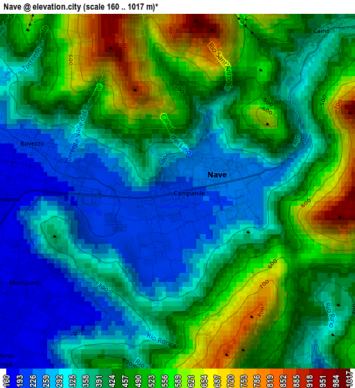
Below is the Elevation map of Nave, which displays elevation range with different colors. Scale of the first map is from 160 to 1017 m (525 to 3337 ft) with average elevation of 420.3 meters (=1379 ft) [note 1]
These maps also provides idea of topography and contour of this city, they are displayed at different zoom levels. More info about maps, scale and edge coordinates you can find below images.
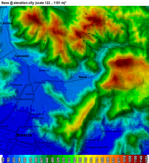
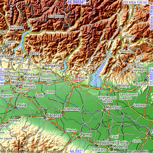
| \ | Map #1 | Map #2 | Topo.Map |
| Scale [m] | 160..1017 m | 122..1181 m | × |
| Scale [ft] | 525..3337 ft | 400..3875 ft | × |
| Average | 420.3 m = 1379 ft | 457.9 m = 1502 ft | × |
| Width | 6.84 km = 4.3 mi | 13.68 km = 8.5 mi | 218.9 km = 136 mi |
| Height | 6.84 km = 4.3 mi | 13.68 km = 8.5 mi | 218.8 km = 136 mi |
| ↑Max Latitude | 45.615547° | 45.646277° | 46.56034° |
| Latitude at center | 45.5848° | 45.5848° | 45.5848° |
| ↓Min Latitude | 45.554036° | 45.523256° | 44.592° |
| ← Min Longitude | 10.235525° | 10.191579° | 8.87322° |
| Longitude center | 10.27947° | 10.27947° | 10.27947° |
| →Max Longitude | 10.323415° | 10.367361° | 11.68572° |
Nearby cities:
Cities around Nave sort by population:
• Brescia elevation 146 m
7.4 km,  222°
222°
• Lumezzane 467 m
7.1 km,  350°
350°
• San Sebastiano 476 m
7.7 km, 346°
• Concesio 213 m
5.4 km,  294°
294°
• Botticino 140 m
6.6 km,  158°
158°
• Bovezzo 191 m
3 km,  281°
281°
• Collebeato 184 m
5.4 km,  265°
265°
• Cellatica 161 m
7.7 km, 267°
• San Vigilio 220 m
7.1 km, 291°
• Serle 494 m
7.4 km,  110°
110°
• Caino 341 m
3.8 km,  43°
43°
• Fantasina 139 m
8 km,  260°
260°
Multilingual:
 En español:
Nave elevación 221 m.
 En France:
Nave élévation 221 m.


Sources and notes:
- [note 1] Map square and city borders are not equal. Map elevation data is calculated only from area inside that square.
- [src 1] Elevation data from geonames database provided with same terms of usage.
- [src 2] The elevation map of Nave is generated using elevation data from NASA's 3 arcsec (90m) resolution SRTM data.
- [src 3] Base (background) map © OpenStreetMap contributors tiles are generated by Geofabrik and OpenTopoMap.
Copyright & License:
This Nave Elevation Map is licensed under CC BY-SA. You may reuse any part from this page, if you give a proper credit by linking to this URL:
 More info on terms of use page.