Nola elevation
Nola (Campania, Napoli), Italy elevation is 50 meters and Nola elevation in feet is 164 ft above sea level [src 1]. Nola is a seat of a third-order administrative division (feature code) with elevation that is 272 meters (892 ft) smaller than average city elevation in Italy.
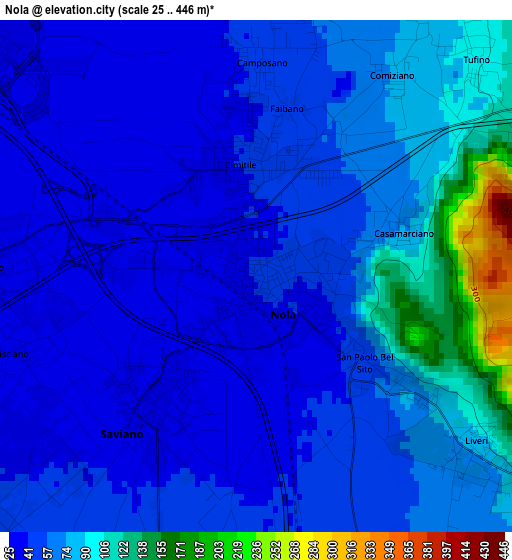
Below is the Elevation map of Nola, which displays elevation range with different colors. Scale of the first map is from 25 to 446 m (82 to 1463 ft) with average elevation of 63.2 meters (=207 ft) [note 1]
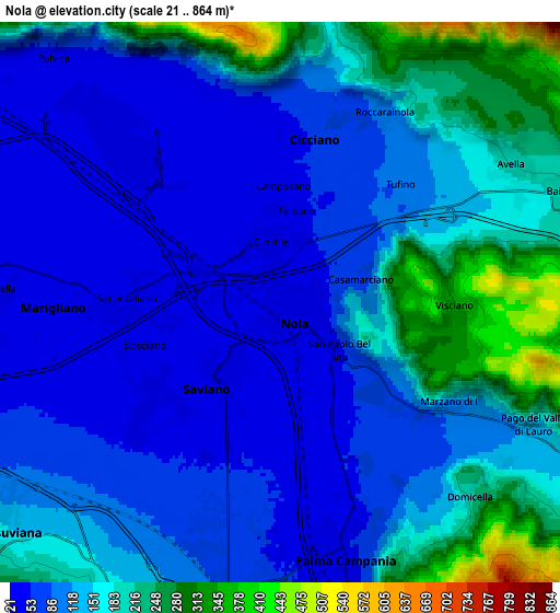
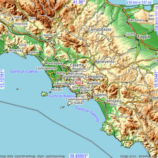
These maps also provides idea of topography and contour of this city, they are displayed at different zoom levels. More info about maps, scale and edge coordinates you can find below images.
| \ | Map #1 | Map #2 | Topo.Map |
| Scale [m] | 25..446 m | 21..864 m | × |
| Scale [ft] | 82..1463 ft | 69..2835 ft | × |
| Average | 63.2 m = 207 ft | 131.5 m = 431 ft | × |
| Width | 7.38 km = 4.6 mi | 14.77 km = 9.2 mi | 236.3 km = 146.8 mi |
| Height | 7.38 km = 4.6 mi | 14.77 km = 9.2 mi | 236.3 km = 146.8 mi |
| ↑Max Latitude | 40.959255° | 40.992433° | 41.98° |
| Latitude at center | 40.92606° | 40.92606° | 40.92606° |
| ↓Min Latitude | 40.892849° | 40.85962° | 39.85503° |
| ← Min Longitude | 14.484215° | 14.440269° | 13.12191° |
| Longitude center | 14.52816° | 14.52816° | 14.52816° |
| →Max Longitude | 14.572105° | 14.616051° | 15.93441° |
Nearby cities:
Cities around Nola sort by population:
• Saviano elevation 38 m
3 km,  219°
219°
• Cicciano 50 m
4.3 km,  7°
7°
• Cimitile 44 m
1.8 km,  353°
353°
• San Vitaliano 31 m
4.5 km,  267°
267°
• Camposano 45 m
2.9 km,  2°
2°
• Visciano 337 m
4.6 km,  93°
93°
• San Paolo Bel Sito 54 m
2.2 km,  129°
129°
• Casamarciano 73 m
2.2 km,  72°
72°
• Tufino 97 m
4.6 km,  43°
43°
• Liveri 82 m
4 km, 128°
• Piazzolla 54 m
4.2 km,  194°
194°
• Comiziano 74 m
3.4 km,  34°
34°
Multilingual:
 En español:
Nola elevación 50 m.
 En France:
Nola élévation 50 m.


Sources and notes:
- [note 1] Map square and city borders are not equal. Map elevation data is calculated only from area inside that square.
- [src 1] Elevation data from geonames database provided with same terms of usage.
- [src 2] The elevation map of Nola is generated using elevation data from NASA's 3 arcsec (90m) resolution SRTM data.
- [src 3] Base (background) map © OpenStreetMap contributors tiles are generated by Geofabrik and OpenTopoMap.
Copyright & License:
This Nola Elevation Map is licensed under CC BY-SA. You may reuse any part from this page, if you give a proper credit by linking to this URL:
 More info on terms of use page.