Padulle elevation
Padulle (Emilia-Romagna, Bologna), Italy elevation is 22 meters and Padulle elevation in feet is 72 ft above sea level [src 1]. Padulle is a seat of a third-order administrative division (feature code) with elevation that is 300 meters (984 ft) smaller than average city elevation in Italy.
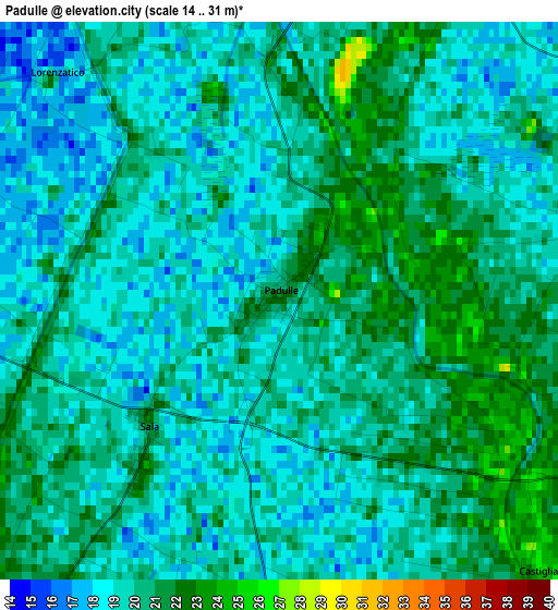
Below is the Elevation map of Padulle, which displays elevation range with different colors. Scale of the first map is from 14 to 31 m (46 to 102 ft) with average elevation of 19.6 meters (=64 ft) [note 1]
These maps also provides idea of topography and contour of this city, they are displayed at different zoom levels. More info about maps, scale and edge coordinates you can find below images.
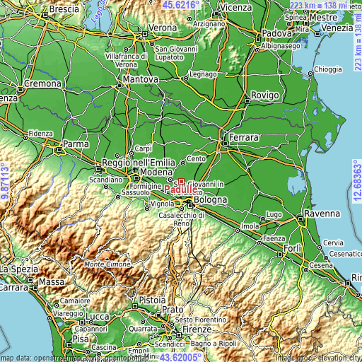
| \ | Map #1 | Topo.Map |
| Scale [m] | 14..31 m | × |
| Scale [ft] | 46..102 ft | × |
| Average | 19.6 m = 64 ft | × |
| Width | 6.95 km = 4.3 mi | 222.6 km = 138.3 mi |
| Height | 6.95 km = 4.3 mi | 222.5 km = 138.3 mi |
| ↑Max Latitude | 44.660716° | 45.6216° |
| Latitude at center | 44.62945° | 44.62945° |
| ↓Min Latitude | 44.598167° | 43.62005° |
| ← Min Longitude | 11.233435° | 9.87113° |
| Longitude center | 11.27738° | 11.27738° |
| →Max Longitude | 11.321325° | 12.68363° |
Nearby cities:
Cities around Padulle sort by population:
• Castel Maggiore elevation 29 m
8.8 km,  131°
131°
• San Giovanni in Persiceto 23 m
7.4 km,  277°
277°
• Calderara di Reno 28 m
7.4 km,  183°
183°
• Pieve di Cento 19 m
9.6 km,  15°
15°
• San Giorgio di Piano 22 m
7.9 km,  75°
75°
• Castello d'Argile 19 m
5.6 km, 16°
• Argelato 23 m
5.4 km, 77°
• Trebbo 32 m
8.8 km,  157°
157°
• Osteria Nuova 28 m
5.9 km,  212°
212°
• Longara 31 m
6.8 km, 162°
• Sala Bolognese 21 m
2.4 km,  223°
223°
• Venezzano 13 m
7.4 km,  36°
36°
Multilingual:
 En español:
Padulle elevación 22 m.
 En France:
Padulle élévation 22 m.


Sources and notes:
- [note 1] Map square and city borders are not equal. Map elevation data is calculated only from area inside that square.
- [src 1] Elevation data from geonames database provided with same terms of usage.
- [src 2] The elevation map of Padulle is generated using elevation data from NASA's 3 arcsec (90m) resolution SRTM data.
- [src 3] Base (background) map © OpenStreetMap contributors tiles are generated by Geofabrik and OpenTopoMap.
Copyright & License:
This Padulle Elevation Map is licensed under CC BY-SA. You may reuse any part from this page, if you give a proper credit by linking to this URL:
 More info on terms of use page.