Bettola-Zeloforomagno elevation
Bettola-Zeloforomagno (Lombardy, Città metropolitana di Milano), Italy elevation is 106 meters and Bettola-Zeloforomagno elevation in feet is 348 ft above sea level [src 1]. Bettola-Zeloforomagno is a seat of a third-order administrative division (feature code) with elevation that is 216 meters (709 ft) smaller than average city elevation in Italy.
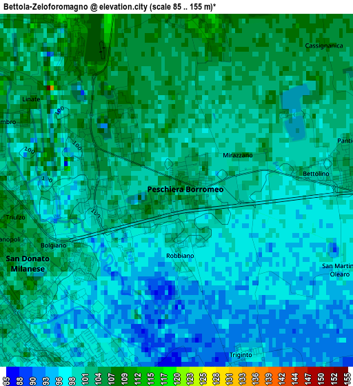
Below is the Elevation map of Bettola-Zeloforomagno, which displays elevation range with different colors. Scale of the first map is from 85 to 155 m (279 to 509 ft) with average elevation of 100.4 meters (=329 ft) [note 1]
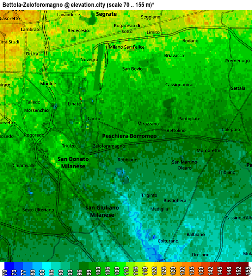
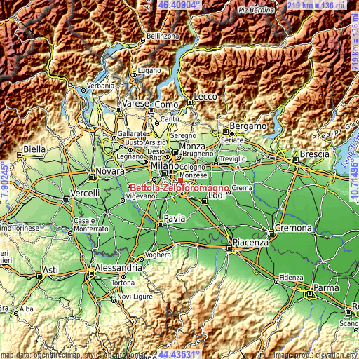
These maps also provides idea of topography and contour of this city, they are displayed at different zoom levels. More info about maps, scale and edge coordinates you can find below images.
| \ | Map #1 | Map #2 | Topo.Map |
| Scale [m] | 85..155 m | 70..155 m | × |
| Scale [ft] | 279..509 ft | 230..509 ft | × |
| Average | 100.4 m = 329 ft | 102.5 m = 336 ft | × |
| Width | 6.86 km = 4.3 mi | 13.72 km = 8.5 mi | 219.5 km = 136.4 mi |
| Height | 6.86 km = 4.3 mi | 13.72 km = 8.5 mi | 219.4 km = 136.3 mi |
| ↑Max Latitude | 45.461631° | 45.492445° | 46.40904° |
| Latitude at center | 45.4308° | 45.4308° | 45.4308° |
| ↓Min Latitude | 45.399952° | 45.369087° | 44.43531° |
| ← Min Longitude | 9.264755° | 9.220809° | 7.90245° |
| Longitude center | 9.3087° | 9.3087° | 9.3087° |
| →Max Longitude | 9.352645° | 9.396591° | 10.71495° |
Nearby cities:
Cities around Bettola-Zeloforomagno sort by population:
• San Giuliano Milanese elevation 98 m
4.3 km,  198°
198°
• San Donato Milanese 107 m
3.9 km,  234°
234°
• Pantigliate 100 m
3.4 km,  81°
81°
• Novegro-Tregarezzo-San Felice 112 m
4.6 km,  332°
332°
• San Bovio-San Felice 110 m
3.6 km,  4°
4°
• Mombretto 100 m
4.5 km,  99°
99°
• Vigliano-Bettolino 101 m
2.8 km,  85°
85°
• Mezzate 105 m
1.8 km,  322°
322°
• Millepini 112 m
4.9 km,  27°
27°
• Mediglia 94 m
4.3 km,  155°
155°
• Triginto 96 m
3.4 km, 158°
• Linate 107 m
3.4 km,  302°
302°
Multilingual:
 En español:
Bettola-Zeloforomagno elevación 106 m.
 En France:
Bettola-Zeloforomagno élévation 106 m.
 Auf Deutsch:
Bettola-Zeloforomagno höhe über dem Meeresspiegel ist 106 m.
 На русском:
Bettola-Zeloforomagno высота над уровнем моря 106 м
Sources and notes:
- [note 1] Map square and city borders are not equal. Map elevation data is calculated only from area inside that square.
- [src 1] Elevation data from geonames database provided with same terms of usage.
- [src 2] The elevation map of Bettola-Zeloforomagno is generated using elevation data from NASA's 3 arcsec (90m) resolution SRTM data.
- [src 3] Base (background) map © OpenStreetMap contributors tiles are generated by Geofabrik and OpenTopoMap.
Copyright & License:
This Bettola-Zeloforomagno Elevation Map is licensed under CC BY-SA. You may reuse any part from this page, if you give a proper credit by linking to this URL:
 More info on terms of use page.