Pizzone elevation
Pizzone (Molise, Provincia di Isernia), Italy elevation is 676 meters and Pizzone elevation in feet is 2218 ft above sea level [src 1]. Pizzone is a seat of a third-order administrative division (feature code) with elevation that is 354 meters (1161 ft) bigger than average city elevation in Italy.
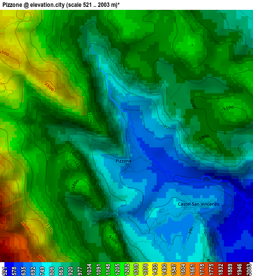
Below is the Elevation map of Pizzone, which displays elevation range with different colors. Scale of the first map is from 521 to 2003 m (1709 to 6572 ft) with average elevation of 995.9 meters (=3267 ft) [note 1]
These maps also provides idea of topography and contour of this city, they are displayed at different zoom levels. More info about maps, scale and edge coordinates you can find below images.
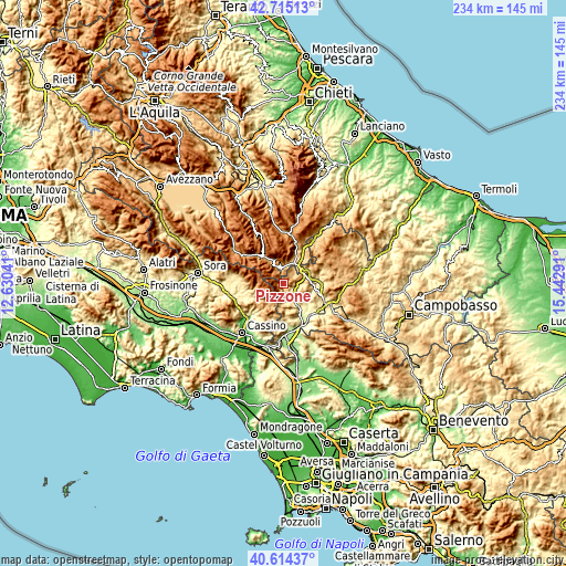
| \ | Map #1 | Topo.Map |
| Scale [m] | 521..2003 m | × |
| Scale [ft] | 1709..6572 ft | × |
| Average | 995.9 m = 3267 ft | × |
| Width | 7.3 km = 4.5 mi | 233.6 km = 145.2 mi |
| Height | 7.3 km = 4.5 mi | 233.6 km = 145.2 mi |
| ↑Max Latitude | 41.706136° | 42.71513° |
| Latitude at center | 41.67332° | 41.67332° |
| ↓Min Latitude | 41.640487° | 40.61437° |
| ← Min Longitude | 13.992715° | 12.63041° |
| Longitude center | 14.03666° | 14.03666° |
| →Max Longitude | 14.080605° | 15.44291° |
Nearby cities:
Cities around Pizzone sort by population:
• Rocchetta a Volturno elevation 550 m
6.8 km,  140°
140°
• Rionero Sannitico 1026 m
9.5 km,  63°
63°
• Alfedena 892 m
6.9 km,  358°
358°
• Colli a Volturno 386 m
9.8 km,  145°
145°
• Barrea 1016 m
9.9 km,  337°
337°
• Rocchetta Nuova 555 m
6.9 km, 143°
• Montenero Val Cocchiara 904 m
5.5 km,  29°
29°
• Acquaviva d'Isernia 719 m
9.2 km,  91°
91°
• Castel San Vincenzo 711 m
2.9 km,  133°
133°
• Cerro al Volturno 505 m
5.9 km,  111°
111°
• Scapoli 596 m
6.8 km,  163°
163°
• Scontrone 1036 m
8.2 km,  1°
1°
Multilingual:
 En español:
Pizzone elevación 676 m.
 En France:
Pizzone élévation 676 m.


Sources and notes:
- [note 1] Map square and city borders are not equal. Map elevation data is calculated only from area inside that square.
- [src 1] Elevation data from geonames database provided with same terms of usage.
- [src 2] The elevation map of Pizzone is generated using elevation data from NASA's 3 arcsec (90m) resolution SRTM data.
- [src 3] Base (background) map © OpenStreetMap contributors tiles are generated by Geofabrik and OpenTopoMap.
Copyright & License:
This Pizzone Elevation Map is licensed under CC BY-SA. You may reuse any part from this page, if you give a proper credit by linking to this URL:
 More info on terms of use page.