Pollutri elevation
Pollutri (Abruzzo, Provincia di Chieti), Italy elevation is 184 meters and Pollutri elevation in feet is 604 ft above sea level [src 1]. Pollutri is a seat of a third-order administrative division (feature code) with elevation that is 138 meters (453 ft) smaller than average city elevation in Italy.
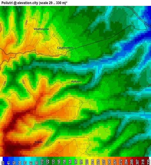
Below is the Elevation map of Pollutri, which displays elevation range with different colors. Scale of the first map is from 29 to 330 m (95 to 1083 ft) with average elevation of 164.5 meters (=540 ft) [note 1]
These maps also provides idea of topography and contour of this city, they are displayed at different zoom levels. More info about maps, scale and edge coordinates you can find below images.
| \ | Map #1 | Topo.Map |
| Scale [m] | 29..330 m | × |
| Scale [ft] | 95..1083 ft | × |
| Average | 164.5 m = 540 ft | × |
| Width | 7.25 km = 4.5 mi | 231.9 km = 144.1 mi |
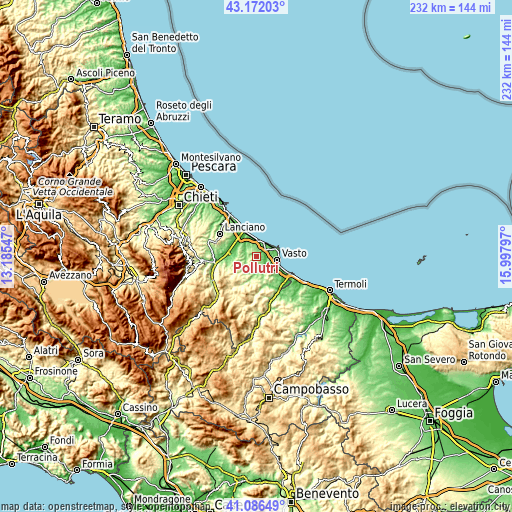
| Height | 7.25 km = 4.5 mi | 231.9 km = 144.1 mi |
| ↑Max Latitude | 42.170419° | 43.17203° |
| Latitude at center | 42.13784° | 42.13784° |
| ↓Min Latitude | 42.105245° | 41.08649° |
| ← Min Longitude | 14.547775° | 13.18547° |
| Longitude center | 14.59172° | 14.59172° |
| →Max Longitude | 14.635665° | 15.99797° |
Nearby cities:
Cities around Pollutri sort by population:
• Vasto elevation 149 m
9.9 km,  107°
107°
• Casalbordino-Miracoli 152 m
1.8 km,  19°
19°
• Atessa 418 m
13.9 km,  237°
237°
• Cupello 282 m
10 km,  139°
139°
• Paglieta 229 m
7.8 km,  289°
289°
• Scerni 275 m
4 km,  201°
201°
• Marina di Vasto 7 m
12.2 km, 113°
• Gissi 489 m
13.9 km, 196°
• Monteodorisio 267 m
7.8 km, 138°
• Torino di Sangro 128 m
7.2 km,  325°
325°
• Casalanguida 467 m
13.7 km,  215°
215°
• Villalfonsina 193 m
3.1 km,  323°
323°
Multilingual:
 En español:
Pollutri elevación 184 m.
 En France:
Pollutri élévation 184 m.
 Auf Deutsch:
Pollutri höhe über dem Meeresspiegel ist 184 m.

Sources and notes:
- [note 1] Map square and city borders are not equal. Map elevation data is calculated only from area inside that square.
- [src 1] Elevation data from geonames database provided with same terms of usage.
- [src 2] The elevation map of Pollutri is generated using elevation data from NASA's 3 arcsec (90m) resolution SRTM data.
- [src 3] Base (background) map © OpenStreetMap contributors tiles are generated by Geofabrik and OpenTopoMap.
Copyright & License:
This Pollutri Elevation Map is licensed under CC BY-SA. You may reuse any part from this page, if you give a proper credit by linking to this URL:
 More info on terms of use page.