Atessa elevation
Atessa (Abruzzo, Provincia di Chieti), Italy elevation is 418 meters and Atessa elevation in feet is 1371 ft above sea level [src 1]. Atessa is a seat of a third-order administrative division (feature code) with elevation that is 96 meters (315 ft) bigger than average city elevation in Italy.
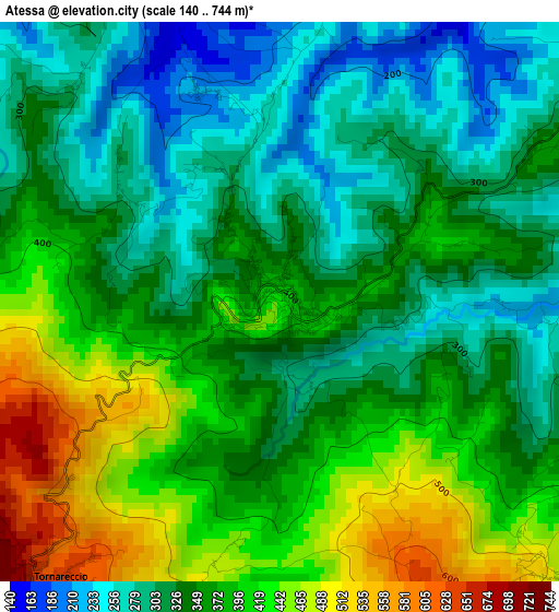
Below is the Elevation map of Atessa, which displays elevation range with different colors. Scale of the first map is from 140 to 744 m (459 to 2441 ft) with average elevation of 357 meters (=1171 ft) [note 1]
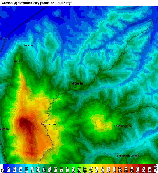
These maps also provides idea of topography and contour of this city, they are displayed at different zoom levels. More info about maps, scale and edge coordinates you can find below images.
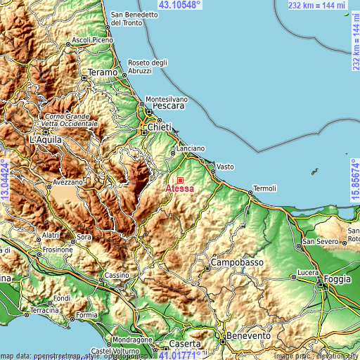
| \ | Map #1 | Map #2 | Topo.Map |
| Scale [m] | 140..744 m | 65..1016 m | × |
| Scale [ft] | 459..2441 ft | 213..3333 ft | × |
| Average | 357 m = 1171 ft | 340.6 m = 1117 ft | × |
| Width | 7.25 km = 4.5 mi | 14.51 km = 9 mi | 232.1 km = 144.2 mi |
| Height | 7.25 km = 4.5 mi | 14.51 km = 9 mi | 232.1 km = 144.2 mi |
| ↑Max Latitude | 42.102793° | 42.13539° | 43.10548° |
| Latitude at center | 42.07018° | 42.07018° | 42.07018° |
| ↓Min Latitude | 42.03755° | 42.004903° | 41.01771° |
| ← Min Longitude | 14.406545° | 14.362599° | 13.04424° |
| Longitude center | 14.45049° | 14.45049° | 14.45049° |
| →Max Longitude | 14.494435° | 14.538381° | 15.85674° |
Nearby cities:
Cities around Atessa sort by population:
• Scerni elevation 275 m
10.9 km,  69°
69°
• Gissi 489 m
9.7 km,  126°
126°
• Selva 128 m
10.1 km,  299°
299°
• Tornareccio 643 m
4.6 km,  218°
218°
• Bomba 419 m
8 km,  239°
239°
• Archi 442 m
6.1 km,  292°
292°
• Casalanguida 467 m
5.2 km, 133°
• Carpineto Sinello 379 m
8 km,  146°
146°
• Colledimezzo 489 m
10.7 km,  209°
209°
• Altino 346 m
10.3 km, 288°
• Perano 233 m
5.9 km,  310°
310°
• Guilmi 640 m
8.5 km,  164°
164°
Multilingual:
 En español:
Atessa elevación 418 m.
 En France:
Atessa élévation 418 m.


Sources and notes:
- [note 1] Map square and city borders are not equal. Map elevation data is calculated only from area inside that square.
- [src 1] Elevation data from geonames database provided with same terms of usage.
- [src 2] The elevation map of Atessa is generated using elevation data from NASA's 3 arcsec (90m) resolution SRTM data.
- [src 3] Base (background) map © OpenStreetMap contributors tiles are generated by Geofabrik and OpenTopoMap.
Copyright & License:
This Atessa Elevation Map is licensed under CC BY-SA. You may reuse any part from this page, if you give a proper credit by linking to this URL:
 More info on terms of use page.