Raldon elevation
Raldon (Veneto, Provincia di Verona), Italy elevation is 35 meters and Raldon elevation in feet is 115 ft above sea level [src 1]. Raldon is a populated place (feature code) with elevation that is 287 meters (942 ft) smaller than average city elevation in Italy.
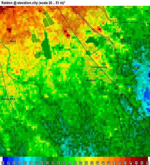
Below is the Elevation map of Raldon, which displays elevation range with different colors. Scale of the first map is from 20 to 51 m (66 to 167 ft) with average elevation of 34.4 meters (=113 ft) [note 1]
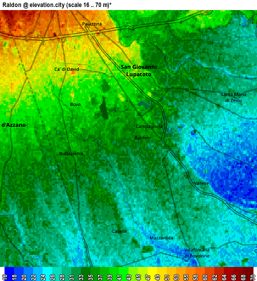
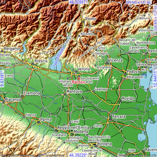
These maps also provides idea of topography and contour of this city, they are displayed at different zoom levels. More info about maps, scale and edge coordinates you can find below images.
| \ | Map #1 | Map #2 | Topo.Map |
| Scale [m] | 20..51 m | 16..70 m | × |
| Scale [ft] | 66..167 ft | 52..230 ft | × |
| Average | 34.4 m = 113 ft | 34.3 m = 113 ft | × |
| Width | 6.87 km = 4.3 mi | 13.74 km = 8.5 mi | 219.8 km = 136.6 mi |
| Height | 6.87 km = 4.3 mi | 13.74 km = 8.5 mi | 219.8 km = 136.6 mi |
| ↑Max Latitude | 45.380086° | 45.410944° | 46.32887° |
| Latitude at center | 45.34921° | 45.34921° | 45.34921° |
| ↓Min Latitude | 45.318318° | 45.287408° | 44.35229° |
| ← Min Longitude | 10.993915° | 10.949969° | 9.63161° |
| Longitude center | 11.03786° | 11.03786° | 11.03786° |
| →Max Longitude | 11.081805° | 11.125751° | 12.44411° |
Nearby cities:
Cities around Raldon sort by population:
• San Giovanni Lupatoto elevation 44 m
3.7 km,  8°
8°
• Zevio 29 m
7.6 km,  70°
70°
• San Martino Buon Albergo 46 m
9.2 km,  29°
29°
• Beccacivetta-Azzano 48 m
6.6 km,  295°
295°
• Isola della Scala 27 m
9.2 km,  194°
194°
• Vigasio 35 m
8.1 km,  244°
244°
• Buttapietra 36 m
3.2 km,  253°
253°
• Vallese 31 m
4.4 km,  121°
121°
• Campagnola 41 m
1.4 km,  42°
42°
• Marchesino-Bovo 43 m
3.5 km, 303°
• Ca' degli Oppi 25 m
9.4 km,  129°
129°
• Forette 40 m
7.3 km,  263°
263°
Multilingual:
 En español:
Raldon elevación 35 m.
 En France:
Raldon élévation 35 m.


Sources and notes:
- [note 1] Map square and city borders are not equal. Map elevation data is calculated only from area inside that square.
- [src 1] Elevation data from geonames database provided with same terms of usage.
- [src 2] The elevation map of Raldon is generated using elevation data from NASA's 3 arcsec (90m) resolution SRTM data.
- [src 3] Base (background) map © OpenStreetMap contributors tiles are generated by Geofabrik and OpenTopoMap.
Copyright & License:
This Raldon Elevation Map is licensed under CC BY-SA. You may reuse any part from this page, if you give a proper credit by linking to this URL:
 More info on terms of use page.