Riva del Garda elevation
Riva del Garda (Trentino-Alto Adige, Provincia autonoma di Trento), Italy elevation is 81 meters and Riva del Garda elevation in feet is 266 ft above sea level [src 1]. Riva del Garda is a seat of a third-order administrative division (feature code) with elevation that is 241 meters (791 ft) smaller than average city elevation in Italy.
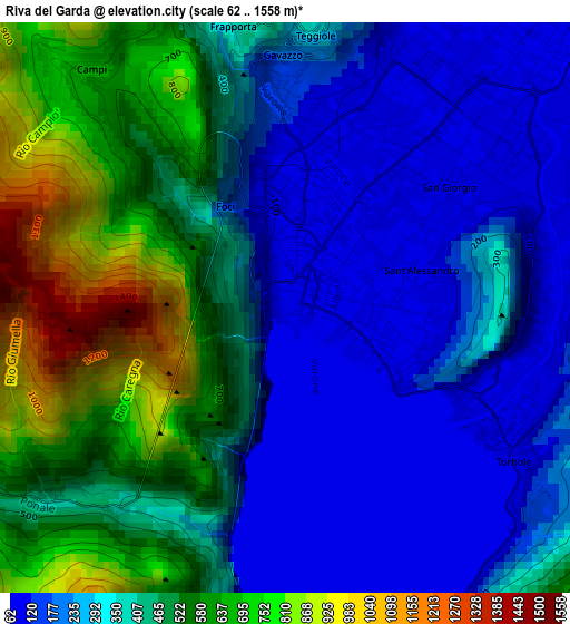
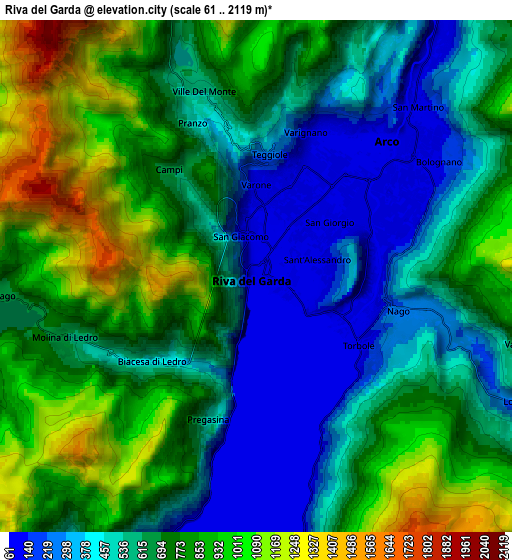
Below is the Elevation map of Riva del Garda, which displays elevation range with different colors. Scale of the first map is from 62 to 1558 m (203 to 5112 ft) with average elevation of 386.6 meters (=1268 ft) [note 1]
These maps also provides idea of topography and contour of this city, they are displayed at different zoom levels. More info about maps, scale and edge coordinates you can find below images.
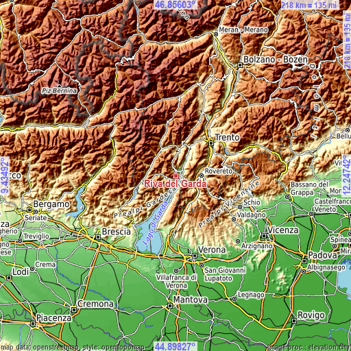
| \ | Map #1 | Map #2 | Topo.Map |
| Scale [m] | 62..1558 m | 61..2119 m | × |
| Scale [ft] | 203..5112 ft | 200..6952 ft | × |
| Average | 386.6 m = 1268 ft | 679.2 m = 2228 ft | × |
| Width | 6.8 km = 4.2 mi | 13.61 km = 8.5 mi | 217.7 km = 135.3 mi |
| Height | 6.8 km = 4.2 mi | 13.61 km = 8.5 mi | 217.7 km = 135.3 mi |
| ↑Max Latitude | 45.916352° | 45.946916° | 46.85603° |
| Latitude at center | 45.88577° | 45.88577° | 45.88577° |
| ↓Min Latitude | 45.855172° | 45.824556° | 44.89827° |
| ← Min Longitude | 10.797225° | 10.753279° | 9.43492° |
| Longitude center | 10.84117° | 10.84117° | 10.84117° |
| →Max Longitude | 10.885115° | 10.929061° | 12.24742° |
Nearby cities:
Cities around Riva del Garda sort by population:
• Arco elevation 91 m
5 km,  44°
44°
• Mori 204 m
11.4 km,  109°
109°
• Bolognano-Vignole 140 m
5.7 km,  59°
59°
• Nago-Torbole 229 m
4 km, 105°
• Dro 123 m
10 km,  33°
33°
• Brentonico 701 m
11.5 km,  130°
130°
• Limone sul Garda 87 m
8.8 km,  205°
205°
• Molina di Ledro 633 m
5.4 km,  252°
252°
• Ronzo-Chienis 976 m
8.4 km,  87°
87°
• Tenno 415 m
3.8 km,  348°
348°
• Pieve di Ledro 660 m
8.5 km,  272°
272°
• Torbole sul Garda 69 m
3.2 km,  124°
124°
Multilingual:
 En español:
Riva del Garda elevación 81 m.
 En France:
Riva del Garda élévation 81 m.
 Auf Deutsch:
Riva del Garda höhe über dem Meeresspiegel ist 81 m.

Sources and notes:
- [note 1] Map square and city borders are not equal. Map elevation data is calculated only from area inside that square.
- [src 1] Elevation data from geonames database provided with same terms of usage.
- [src 2] The elevation map of Riva del Garda is generated using elevation data from NASA's 3 arcsec (90m) resolution SRTM data.
- [src 3] Base (background) map © OpenStreetMap contributors tiles are generated by Geofabrik and OpenTopoMap.
Copyright & License:
This Riva del Garda Elevation Map is licensed under CC BY-SA. You may reuse any part from this page, if you give a proper credit by linking to this URL:
 More info on terms of use page.