Mori elevation
Mori (Trentino-Alto Adige, Provincia autonoma di Trento), Italy elevation is 204 meters and Mori elevation in feet is 669 ft above sea level [src 1]. Mori is a seat of a third-order administrative division (feature code) with elevation that is 118 meters (387 ft) smaller than average city elevation in Italy.
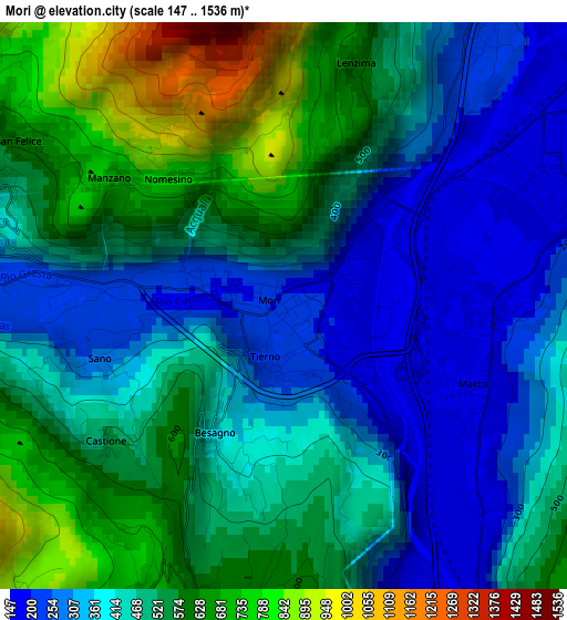
Below is the Elevation map of Mori, which displays elevation range with different colors. Scale of the first map is from 147 to 1536 m (482 to 5039 ft) with average elevation of 465.1 meters (=1526 ft) [note 1]
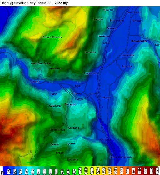
These maps also provides idea of topography and contour of this city, they are displayed at different zoom levels. More info about maps, scale and edge coordinates you can find below images.
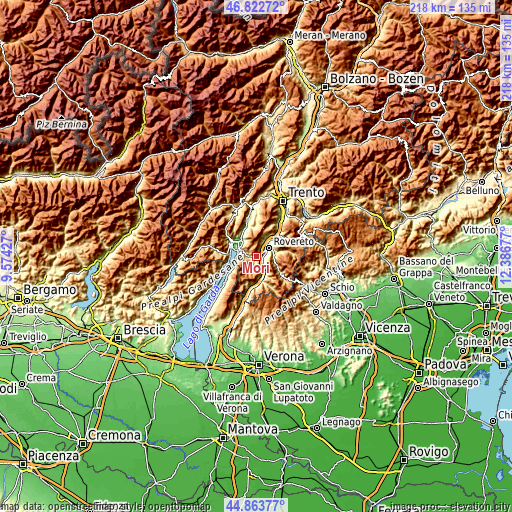
| \ | Map #1 | Map #2 | Topo.Map |
| Scale [m] | 147..1536 m | 77..2038 m | × |
| Scale [ft] | 482..5039 ft | 253..6686 ft | × |
| Average | 465.1 m = 1526 ft | 689.9 m = 2263 ft | × |
| Width | 6.81 km = 4.2 mi | 13.61 km = 8.5 mi | 217.8 km = 135.3 mi |
| Height | 6.81 km = 4.2 mi | 13.61 km = 8.5 mi | 217.8 km = 135.3 mi |
| ↑Max Latitude | 45.88247° | 45.913054° | 46.82272° |
| Latitude at center | 45.85187° | 45.85187° | 45.85187° |
| ↓Min Latitude | 45.821253° | 45.790619° | 44.86377° |
| ← Min Longitude | 10.936575° | 10.892629° | 9.57427° |
| Longitude center | 10.98052° | 10.98052° | 10.98052° |
| →Max Longitude | 11.024465° | 11.068411° | 12.38677° |
Nearby cities:
Cities around Mori sort by population:
• Rovereto elevation 202 m
6.3 km,  47°
47°
• Bolognano-Vignole 140 m
8.9 km,  318°
318°
• Nago-Torbole 229 m
7.4 km,  291°
291°
• Marco 173 m
2.5 km,  114°
114°
• Villa Lagarina 184 m
8.4 km,  28°
28°
• Brentonico 701 m
4.1 km,  208°
208°
• Trambileno 515 m
7.4 km,  75°
75°
• Nogaredo 230 m
7.6 km, 26°
• Isera 235 m
4.6 km, 29°
• Ronzo-Chienis 976 m
4.8 km,  330°
330°
• Moscheri 520 m
7.5 km, 75°
• Torbole sul Garda 69 m
8.4 km,  283°
283°
Multilingual:
 En español:
Mori elevación 204 m.
 En France:
Mori élévation 204 m.


Sources and notes:
- [note 1] Map square and city borders are not equal. Map elevation data is calculated only from area inside that square.
- [src 1] Elevation data from geonames database provided with same terms of usage.
- [src 2] The elevation map of Mori is generated using elevation data from NASA's 3 arcsec (90m) resolution SRTM data.
- [src 3] Base (background) map © OpenStreetMap contributors tiles are generated by Geofabrik and OpenTopoMap.
Copyright & License:
This Mori Elevation Map is licensed under CC BY-SA. You may reuse any part from this page, if you give a proper credit by linking to this URL:
 More info on terms of use page.