Rocca Pia elevation
Rocca Pia (Abruzzo, Provincia dell' Aquila), Italy elevation is 1052 meters and Rocca Pia elevation in feet is 3451 ft above sea level [src 1]. Rocca Pia is a seat of a third-order administrative division (feature code) with elevation that is 730 meters (2395 ft) bigger than average city elevation in Italy.
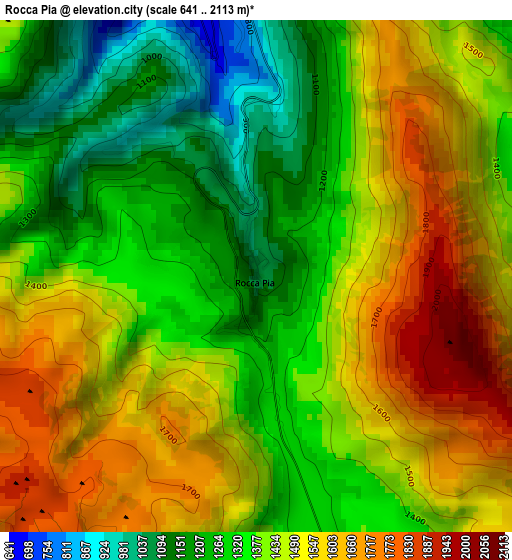
Below is the Elevation map of Rocca Pia, which displays elevation range with different colors. Scale of the first map is from 641 to 2113 m (2103 to 6932 ft) with average elevation of 1425.5 meters (=4677 ft) [note 1]
These maps also provides idea of topography and contour of this city, they are displayed at different zoom levels. More info about maps, scale and edge coordinates you can find below images.
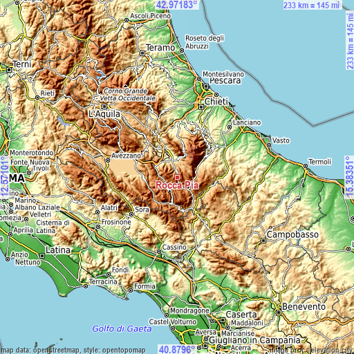
| \ | Map #1 | Topo.Map |
| Scale [m] | 641..2113 m | × |
| Scale [ft] | 2103..6932 ft | × |
| Average | 1425.5 m = 4677 ft | × |
| Width | 7.27 km = 4.5 mi | 232.6 km = 144.5 mi |
| Height | 7.27 km = 4.5 mi | 232.6 km = 144.5 mi |
| ↑Max Latitude | 41.966973° | 42.97183° |
| Latitude at center | 41.93429° | 41.93429° |
| ↓Min Latitude | 41.90159° | 40.8796° |
| ← Min Longitude | 13.933315° | 12.57101° |
| Longitude center | 13.97726° | 13.97726° |
| →Max Longitude | 14.021205° | 15.38351° |
Nearby cities:
Cities around Rocca Pia sort by population:
• Sulmona elevation 410 m
13.5 km,  341°
341°
• Scanno 997 m
8.7 km,  247°
247°
• Roccaraso 1248 m
12.7 km,  138°
138°
• Pacentro 688 m
13 km,  5°
5°
• Pescocostanzo 1367 m
9 km,  125°
125°
• Introdacqua 624 m
10.7 km,  321°
321°
• Campo di Giove 1067 m
9.9 km,  31°
31°
• Bugnara 503 m
13.8 km, 316°
• Rivisondoli 1303 m
10.3 km, 133°
• Villalago 917 m
11.5 km,  270°
270°
• Pettorano sul Gizio 633 m
4.6 km, 341°
• Cansano 847 m
8.3 km,  21°
21°
Multilingual:
 En español:
Rocca Pia elevación 1052 m.
 En France:
Rocca Pia élévation 1052 m.
 Auf Deutsch:
Rocca Pia höhe über dem Meeresspiegel ist 1052 m.

Sources and notes:
- [note 1] Map square and city borders are not equal. Map elevation data is calculated only from area inside that square.
- [src 1] Elevation data from geonames database provided with same terms of usage.
- [src 2] The elevation map of Rocca Pia is generated using elevation data from NASA's 3 arcsec (90m) resolution SRTM data.
- [src 3] Base (background) map © OpenStreetMap contributors tiles are generated by Geofabrik and OpenTopoMap.
Copyright & License:
This Rocca Pia Elevation Map is licensed under CC BY-SA. You may reuse any part from this page, if you give a proper credit by linking to this URL:
 More info on terms of use page.