Sacile elevation
Sacile (Friuli Venezia Giulia, Provincia di Pordenone), Italy elevation is 24 meters and Sacile elevation in feet is 79 ft above sea level [src 1]. Sacile is a seat of a third-order administrative division (feature code) with elevation that is 298 meters (978 ft) smaller than average city elevation in Italy.
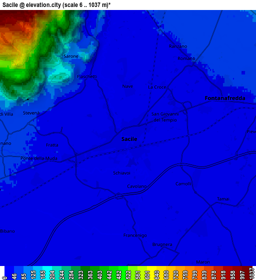
Below is the Elevation map of Sacile, which displays elevation range with different colors. Scale of the first map is from 11 to 221 m (36 to 725 ft) with average elevation of 26.3 meters (=86 ft) [note 1]
These maps also provides idea of topography and contour of this city, they are displayed at different zoom levels. More info about maps, scale and edge coordinates you can find below images.

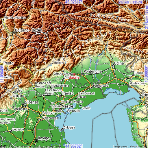
| \ | Map #1 | Map #2 | Topo.Map |
| Scale [m] | 11..221 m | 6..1037 m | × |
| Scale [ft] | 36..725 ft | 20..3402 ft | × |
| Average | 26.3 m = 86 ft | 73.6 m = 241 ft | × |
| Width | 6.79 km = 4.2 mi | 13.59 km = 8.4 mi | 217.4 km = 135.1 mi |
| Height | 6.79 km = 4.2 mi | 13.59 km = 8.4 mi | 217.4 km = 135.1 mi |
| ↑Max Latitude | 45.984664° | 46.015191° | 46.92317° |
| Latitude at center | 45.95412° | 45.95412° | 45.95412° |
| ↓Min Latitude | 45.923559° | 45.892982° | 44.96782° |
| ← Min Longitude | 12.458795° | 12.414849° | 11.09649° |
| Longitude center | 12.50274° | 12.50274° | 12.50274° |
| →Max Longitude | 12.546685° | 12.590631° | 13.90899° |
Nearby cities:
Cities around Sacile sort by population:
• Vigonovo-Fontanafredda elevation 45 m
5.2 km,  41°
41°
• Caneva 44 m
4.3 km,  295°
295°
• Brugnera 16 m
6.8 km,  153°
153°
• Cordignano 57 m
6.8 km,  265°
265°
• Orsago 44 m
6.4 km,  245°
245°
• Godega 53 m
8.7 km, 250°
• Gaiarine 19 m
8.3 km,  191°
191°
• Tamai 19 m
6.3 km,  121°
121°
• Bibano 34 m
7.5 km,  226°
226°
• Francenigo 16 m
5.1 km,  179°
179°
• San Giovanni 50 m
7.5 km,  7°
7°
• Cavolano-Schiavoi 21 m
2.3 km, 185°
Multilingual:
 En español:
Sacile elevación 24 m.
 En France:
Sacile élévation 24 m.


Sources and notes:
- [note 1] Map square and city borders are not equal. Map elevation data is calculated only from area inside that square.
- [src 1] Elevation data from geonames database provided with same terms of usage.
- [src 2] The elevation map of Sacile is generated using elevation data from NASA's 3 arcsec (90m) resolution SRTM data.
- [src 3] Base (background) map © OpenStreetMap contributors tiles are generated by Geofabrik and OpenTopoMap.
Copyright & License:
This Sacile Elevation Map is licensed under CC BY-SA. You may reuse any part from this page, if you give a proper credit by linking to this URL:
 More info on terms of use page.