Vigonovo-Fontanafredda elevation
Vigonovo-Fontanafredda (Friuli Venezia Giulia, Provincia di Pordenone), Italy elevation is 45 meters and Vigonovo-Fontanafredda elevation in feet is 148 ft above sea level [src 1]. Vigonovo-Fontanafredda is a seat of a third-order administrative division (feature code) with elevation that is 277 meters (909 ft) smaller than average city elevation in Italy.
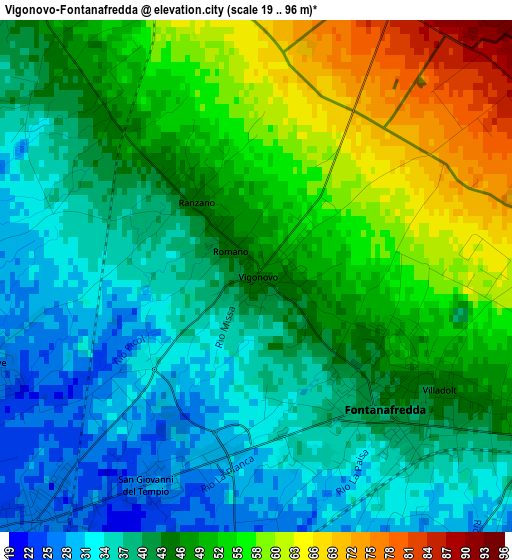
Below is the Elevation map of Vigonovo-Fontanafredda, which displays elevation range with different colors. Scale of the first map is from 19 to 96 m (62 to 315 ft) with average elevation of 45 meters (=148 ft) [note 1]
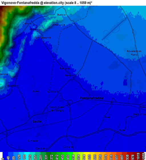
These maps also provides idea of topography and contour of this city, they are displayed at different zoom levels. More info about maps, scale and edge coordinates you can find below images.
| \ | Map #1 | Map #2 | Topo.Map |
| Scale [m] | 19..96 m | 8..1059 m | × |
| Scale [ft] | 62..315 ft | 26..3474 ft | × |
| Average | 45 m = 148 ft | 72.2 m = 237 ft | × |
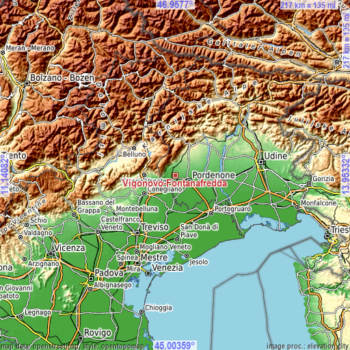
| Width | 6.79 km = 4.2 mi | 13.58 km = 8.4 mi | 217.3 km = 135 mi |
| Height | 6.79 km = 4.2 mi | 13.58 km = 8.4 mi | 217.3 km = 135 mi |
| ↑Max Latitude | 46.019794° | 46.050302° | 46.9577° |
| Latitude at center | 45.98927° | 45.98927° | 45.98927° |
| ↓Min Latitude | 45.958729° | 45.928171° | 45.00359° |
| ← Min Longitude | 12.503125° | 12.459179° | 11.14082° |
| Longitude center | 12.54707° | 12.54707° | 12.54707° |
| →Max Longitude | 12.591015° | 12.634961° | 13.95332° |
Nearby cities:
Cities around Vigonovo-Fontanafredda sort by population:
• Pordenone elevation 24 m
9.5 km,  112°
112°
• Sacile 24 m
5.2 km,  221°
221°
• Porcia 32 m
6.1 km,  118°
118°
• Caneva 44 m
7.6 km,  254°
254°
• Aviano-Castello 159 m
9.1 km,  17°
17°
• Roveredo in Piano 94 m
6 km,  69°
69°
• Budoia 143 m
6.2 km,  350°
350°
• Tamai 19 m
7.5 km,  165°
165°
• Francenigo 16 m
9.6 km,  200°
200°
• Polcenigo 67 m
6.4 km,  328°
328°
• San Giovanni 50 m
4.3 km, 325°
• Cavolano-Schiavoi 21 m
7.2 km,  210°
210°
Multilingual:
 En español:
Vigonovo-Fontanafredda elevación 45 m.
 En France:
Vigonovo-Fontanafredda élévation 45 m.
 Auf Deutsch:
Vigonovo-Fontanafredda höhe über dem Meeresspiegel ist 45 m.
 На русском:
Vigonovo-Fontanafredda высота над уровнем моря 45 м
Sources and notes:
- [note 1] Map square and city borders are not equal. Map elevation data is calculated only from area inside that square.
- [src 1] Elevation data from geonames database provided with same terms of usage.
- [src 2] The elevation map of Vigonovo-Fontanafredda is generated using elevation data from NASA's 3 arcsec (90m) resolution SRTM data.
- [src 3] Base (background) map © OpenStreetMap contributors tiles are generated by Geofabrik and OpenTopoMap.
Copyright & License:
This Vigonovo-Fontanafredda Elevation Map is licensed under CC BY-SA. You may reuse any part from this page, if you give a proper credit by linking to this URL:
 More info on terms of use page.