San Leonardo elevation
San Leonardo (Aosta Valley, Valle d'Aosta), Italy elevation is 1534 meters and San Leonardo elevation in feet is 5033 ft above sea level [src 1]. San Leonardo is a seat of a third-order administrative division (feature code) with elevation that is 1212 meters (3976 ft) bigger than average city elevation in Italy.
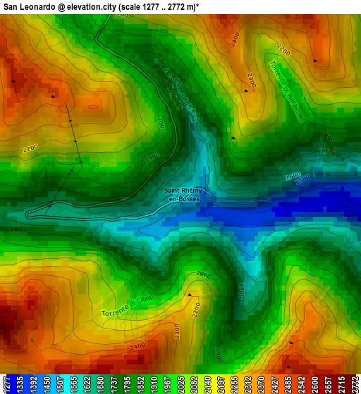
Below is the Elevation map of San Leonardo, which displays elevation range with different colors. Scale of the first map is from 1277 to 2772 m (4190 to 9094 ft) with average elevation of 2001.4 meters (=6566 ft) [note 1]
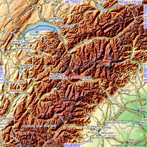
These maps also provides idea of topography and contour of this city, they are displayed at different zoom levels. More info about maps, scale and edge coordinates you can find below images.
| \ | Map #1 | Topo.Map |
| Scale [m] | 1277..2772 m | × |
| Scale [ft] | 4190..9094 ft | × |
| Average | 2001.4 m = 6566 ft | × |
| Width | 6.81 km = 4.2 mi | 217.9 km = 135.4 mi |
| Height | 6.81 km = 4.2 mi | 217.9 km = 135.4 mi |
| ↑Max Latitude | 45.854276° | 46.79501° |
| Latitude at center | 45.82366° | 45.82366° |
| ↓Min Latitude | 45.793027° | 44.83506° |
| ← Min Longitude | 7.137455° | 5.77515° |
| Longitude center | 7.1814° | 7.1814° |
| →Max Longitude | 7.225345° | 8.58765° |
Nearby cities:
Cities around San Leonardo sort by population:
• La Salle elevation 1008 m
12.1 km,  223°
223°
• La Cretaz-Roisan 873 m
11.1 km,  113°
113°
• Gignod 942 m
10.2 km,  118°
118°
• Valpelline 949 m
11.2 km,  89°
89°
• Etroubles 1278 m
3.9 km, 94°
• Saint-Nicolas 1208 m
12 km,  185°
185°
• Saint-Oyen 1366 m
2.5 km, 88°
• Doues 1184 m
9.7 km, 92°
• Allein 1215 m
7.3 km,  104°
104°
• Ollomont 1375 m
10.4 km,  73°
73°
• Ville Sur Sarre 1207 m
11.7 km,  149°
149°
• Saint-Rhémy 1639 m
1.3 km,  8°
8°
Multilingual:
 En español:
San Leonardo elevación 1534 m.
 En France:
San Leonardo élévation 1534 m.
 Auf Deutsch:
San Leonardo höhe über dem Meeresspiegel ist 1534 m.

Sources and notes:
- [note 1] Map square and city borders are not equal. Map elevation data is calculated only from area inside that square.
- [src 1] Elevation data from geonames database provided with same terms of usage.
- [src 2] The elevation map of San Leonardo is generated using elevation data from NASA's 3 arcsec (90m) resolution SRTM data.
- [src 3] Base (background) map © OpenStreetMap contributors tiles are generated by Geofabrik and OpenTopoMap.
Copyright & License:
This San Leonardo Elevation Map is licensed under CC BY-SA. You may reuse any part from this page, if you give a proper credit by linking to this URL:
 More info on terms of use page.