Sannicandro Garganico elevation
Sannicandro Garganico (Apulia, Provincia di Foggia), Italy elevation is 217 meters and Sannicandro Garganico elevation in feet is 712 ft above sea level [src 1]. Sannicandro Garganico is a seat of a third-order administrative division (feature code) with elevation that is 105 meters (344 ft) smaller than average city elevation in Italy.
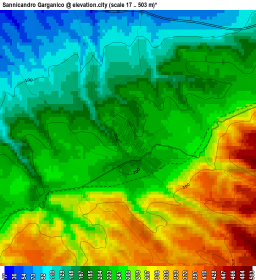
Below is the Elevation map of Sannicandro Garganico, which displays elevation range with different colors. Scale of the first map is from 17 to 503 m (56 to 1650 ft) with average elevation of 226.8 meters (=744 ft) [note 1]
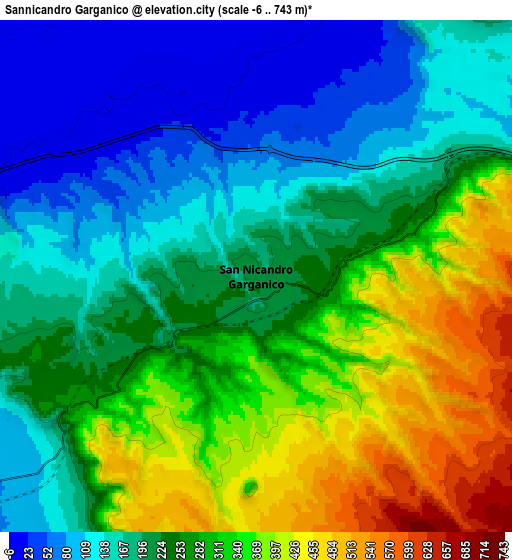
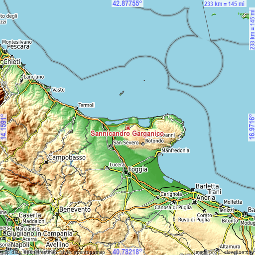
These maps also provides idea of topography and contour of this city, they are displayed at different zoom levels. More info about maps, scale and edge coordinates you can find below images.
| \ | Map #1 | Map #2 | Topo.Map |
| Scale [m] | 17..503 m | -6..743 m | × |
| Scale [ft] | 56..1650 ft | -20..2438 ft | × |
| Average | 226.8 m = 744 ft | 245.5 m = 805 ft | × |
| Width | 7.28 km = 4.5 mi | 14.56 km = 9 mi | 233 km = 144.8 mi |
| Height | 7.28 km = 4.5 mi | 14.56 km = 9 mi | 233 km = 144.8 mi |
| ↑Max Latitude | 41.871172° | 41.903888° | 42.87755° |
| Latitude at center | 41.83844° | 41.83844° | 41.83844° |
| ↓Min Latitude | 41.805691° | 41.772925° | 40.78218° |
| ← Min Longitude | 15.521405° | 15.477459° | 14.1591° |
| Longitude center | 15.56535° | 15.56535° | 15.56535° |
| →Max Longitude | 15.609295° | 15.653241° | 16.9716° |
Nearby cities:
Cities around Sannicandro Garganico sort by population:
• San Severo elevation 92 m
22.8 km,  221°
221°
• San Giovanni Rotondo 570 m
19.9 km,  137°
137°
• Torremaggiore 167 m
28 km,  233°
233°
• San Marco in Lamis 559 m
15.3 km,  156°
156°
• Apricena 74 m
11.6 km,  240°
240°
• Cagnano Varano 156 m
17.2 km,  93°
93°
• Lesina 7 m
17.8 km,  278°
278°
• San Paolo di Civitate 189 m
27.6 km,  246°
246°
• Carpino 142 m
24.2 km, 88°
• Rodi Garganico 62 m
28 km,  69°
69°
• Poggio Imperiale 73 m
16.5 km,  264°
264°
• Rignano Garganico 579 m
17.8 km,  173°
173°
Multilingual:
 En español:
Sannicandro Garganico elevación 217 m.
 En France:
Sannicandro Garganico élévation 217 m.
 Auf Deutsch:
Sannicandro Garganico höhe über dem Meeresspiegel ist 217 m.
 На русском:
Sannicandro Garganico высота над уровнем моря 217 м
Sources and notes:
- [note 1] Map square and city borders are not equal. Map elevation data is calculated only from area inside that square.
- [src 1] Elevation data from geonames database provided with same terms of usage.
- [src 2] The elevation map of Sannicandro Garganico is generated using elevation data from NASA's 3 arcsec (90m) resolution SRTM data.
- [src 3] Base (background) map © OpenStreetMap contributors tiles are generated by Geofabrik and OpenTopoMap.
Copyright & License:
This Sannicandro Garganico Elevation Map is licensed under CC BY-SA. You may reuse any part from this page, if you give a proper credit by linking to this URL:
 More info on terms of use page.